


INSTRUCTING STRUCTURES

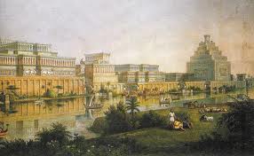
“Every dawn, the Earth is subjected to a rise in the solar wind which intensifies the planet’s geomagnetic field; at night this field weakens, then picks up at dawn and the cycle repeats. Where the geomagnetic field interacts with another force the effect intensifies.” Scientists call this a telluric current; “ancient people call it a spirit road. These lines of force travel better along with soil with a high content of metal, water, and quartz. Drier, less metallic ground conducts telluric currents minimally. Where a boundary between these two types of land occurs, the telluric current crossing it either reinforces or weakens the daily fluctuations of the geomagnetic field. This generates a hotspot, a CONDUCTIVITY DISCONTINUITY.” At sites our genetic makers from Nibiru–the Anunnaki–established all over this planet, telluric energy affects the mind, creativity, and personal power. It “raises one’s resonance. Contact with multiple power places builds up spiritual attuning, a numinous state of mind, and forms the basis of pilgrimage” from one site to the next. Perceptual reality commonly experienced and reinforced by people of similar purpose over long periods of time marks the locations as sacred.” Anunnaki temples were carefully aligned on the globe, as you see on the illustration.
THE HARTMANN NET
“A woven electromagnetic grid,” the Hartmann net, “exists over the entire face of the globe, composed of small rectangular nets, rising from the earth, each line is 9 inches thick and placed at intervals of 6 feet by 6 inches by 8 feet, magnetically-oriented. The intersecting points of the network–the knots–are influenced by underground veins of water as well as magnetic forces emanating from the earth.
“Giant telluric waves, undulating vertically and linked to the geomagnetic field of Earth, create a network of crisscrossing lines all around the planet.” Anunnaki put their structures where lines crisscross.
Sacred sites‘ “exact place of veneration is located in a spot where the geomagnetic field is more pronounced, accessed by a “spirit road, a telluric current–electromagnetic pathway that flows across the face of the Earth. Sacred sites connected to one another through common narratives, myths, and folklore. All share accurate triangles.”
“People communing at the sites fly astrally. They’re “sent flying by an electromagnetic charge in quartz or magnetite, touching it or grounded in its energy. The local magnetic field is drawn like a whirlpool into the center of the temple. Stones store and direct the flow of terrestrial energy. ” Meditate at a sacred site, tap into the power of the world-wide grid and amplify your psychic abilities and spiritual consciousness and you feel this energy and commune with your ancestors from the stars directly.
The builders marked crossing points with temples and standing stones. Elongated shapes–menhirs, steeples or towers) acted as antennae, attracted “cosmo telluric waves” that continue to flow through the worldwide network.
“Tens of thousands of sacred sites still stand in every country on Earth. These sites share colossal stones, often hauled from hundreds of miles away, aligned to the heliacal rising of specific stars and mirror entire constellations, compute with regularity the solar and lunar calendars, solstices and equinoxes. They were built to last into an age when humanity would lose its connection with the divine. These temples were places where the individual could be transformed into a god. Their purpose was self-realization of the individual through the transfiguration of the soul.”
“These cosmo-telluric lines” let the Anunnaki, other ETs on Earth and our ancestors “gather a whole body of knowledge.” We can, at these sites, “trigger a shift to a heightened and more spiritual state of consciousness.” Though the ETs choose the sites, our ancestors in every era and on every land anchored them with stones and buildings. Once fixed, our forefathers’ reinforced the broadcasting power when they prayed at the sites. Our genitors experienced “planetary consciousness when they did rituals at the big-stone sites,” and you can too when you meditate at a Megalithic temple.
SEVEN ASPECTS THAT SACRALIZE ANUNNAKI TEMPLES
Silva identified the aspects that make Anunnaki temples sacred and continue to make the later temples and churches built atop them sacred too. The seven principles of sacred space are “water, electromagnetics, sacred measure, stone, sacred geometry, orientation, and the human key.”
1) WATER
Every Anunnaki sacred site, “without exception is located above or beside the water. Water is the foundation of every temple.” Enki, Ningishzidda, and their assistants distilled the energy of the water of the sacred sites; they inserted metal rods to keep water charged with healing properties–the CONSECRATED WATER–at the site from water whose charge would harm people. “So long as the purity of the water is maintained at the site, the potentially destructive telluric forces of the earth do not interfere with the processes at work inside the sanctuary. Energized water behaves as a force field. The prime energy spots in sacred sites tend to be those from which a number of underground streams form a radial pattern. Water at sacred sites is different in frequency from ordinary water.” Spectroscopy of such water shows it free from bacteria and full of “natural minerals beneficial to health and longevity. This extremely pure water exhibits greater properties of spin. Such vortices create an electrical charge which then generates an electromagnetic field to transform it into something different from the ordinary liquid.” It becomes holy water. “Its potency can be enhanced by crystals, particularly quartz, the prime material used in temple-building. This energized water, the primary ingredient of sacred space” is also “a major stimulant of the human body that benefits most from using the temple.
“Our bodies consist of 2/3 water, just like the Earth, and 90% of the brain is made up of the stuff. Water retains information; drinking it form a sacred site means one imbibes whatever is stored in the memory is stored in the memory of the place, natural energy as well as the energy from affirmations and prayers accumulated over thousands of years. Our blood requires a vorticular motion to move through the vials. Properties of water at sacred sites affects the spin ratio of blood, altering the information traveling through the body and makes us more receptive to the processes taking place inside the temple.
“The effects of concentrated thought to alter the shape of water have been illustrated by Emoto. The directed intent from ordinary people aimed at vials of water shows the ability of a word such as love to alter the crystalline structure of water.”
2) ELECTROMAGNETICS
“The Hartmann Net’s intersection points, without Anunnaki grounding, hurt the health of those near. The Anunnaki and later dowsers cleared these effects at sacred sites “by embedding conductors such as metal rods in the ground, which stretch the electromagnetic net away.
“The blood that flows through our veins and arteries carries iron, magnetism reorganizes iron for the brain tissue and the cerebral cortex. These pyramid-shaped crystals allow humans to detect the Earth’s magnetic field.” Magnetic stimulation of the brain creates the coherent, negentropic conditions that can yield an altered state of consciousness in receptive people. The site and the people become one. Also, “human bone is a crystalline structure through which flows an electrical charge.
“Geobiologist Blanch Merz conducted reading at temples in Europe, Egypt, and India and found the Hartmann Net stretched around the temples like a protective membrane.” She wrote “‘The Hartmann network forms a dam of 18 geomagnetic lines around the perimeters of the buildings.’ Temples at Saqqara, Karnak, Luxor, and Kom Ombu [Egypt] enjoy an immense neutral zone the same way the henge at Stonehenge [England] circulate electromagnetic forces which concentrate the energy inside the temples in a controlled manner beneficial to people. Merz found other energy hotspots at Chartes, Santiago de Compostela, Indian sacred sites; in Tibet, she found that the stupas marked with the nagas [serpents symbolizing electricity mastery] identify the position of Hartmann knot. Telluric energy is transmitted via these upright stones. The ceremonial chamber at New Grange [Ireland] is protected by alternating energy currents with seven positively-charged lines anchored on either side of the chambered passageway before reaching the inner sanctum as a preparatory area for the initiate prior to crossing the threshold between visible and invisible.”
3) SACRED MEASURE BY THE CUBIT, THE TRANSDIMENSIONAL CONSTANT
The Anunnaki used the cubit, 2.72, from which they derived the primary geometric building blocks, tetrahedrons and spheres to layout temples and extrapolate all the numbers relating to Earth, orbits of the planets, musical scale ratios, space between water molecules, star triangulation and make this info available to all who study their temples.
4) STONE
“When the builders located the veins of water located, they insulated the safe electromagnetism and measured out the site, they added large amounts of quartz, a trainable piezoelectric substance to the site.” The Anunnaki brought stone from afar to temples like the Giza Pyramids and Stonehenge to stop shifting telluric forces from moving and to anchor them to the sites.
The builders considered the Sun masculine, “its energetic properties mirrored on Earth by volcanic action. Thus volcanic (igneous) rock vectors masculine energy and temples where masculine forces are at work are built predominantly with red granite, basalt, dolerite, greenstone, and serpentine.” The associated energy of the moon as feminine “due to the moon’s influence on fertility cycles of women. Temples designed to vector feminine qualities [Dendera in Egypt, Mediterranean temples dedicated to Inanna or Ninmah, Avebury England’s lunar circle] are built primarily with limestone, sandstone, sarsen, marble, schist, and alabaster.” They built some temples for a balance of masculine and feminine.
5) SACRED GEOMETRY
Geometry and angles in temples “initiate a process of sensory manipulation to open the body’s electrical circuits and make it more receptive to finer, more penetrating frequencies and vibrations. Molecular bonds that constitute matter are held together by a geometric matrix. Geometry is a whirlpool of conscious energy manifesting toward physical form. It’s the language of life. Its blueprint is reflected in human DNA, where four base compounds are arranged in bonds of pentagons and hexagons. We are hypnotically drawn to geometric order because, to our bio geometric cells, it is as if we are looking in the mirror. We are a distillation of the universe.
“Pyramids, spheres, and squares act as resonators for telluric and cosmic forces. Rooms of differing shapes generate different energetic environments that influence the senses.” The Anunnaki builders applied specific geometries to induce the individual’s state of awareness to teach self-understanding to facilitate self-development by initiates who understood how to translate shape and symbolism [eg: mandalas, yantras] into meditative exercises that lead to higher states of consciousness, to re-establish unity between body, mind, and cosmos.
“Temples at Luxor [Egypt] Angkor Wat [Cambodia], and the Parthenon [Athens] are based on the GOLDEN RATIO, the spiral that underlies all living organisms. The same proportions are inherent in the human body. Walking into such temples makes you feel an integral part of the structure because you are walking inside yourself.
“The seven principal sacred geometries used in the temple–triangle, square, pentagram, hexagram, octagon and nonagon–each amplify specific properties. The TRIANGLE represents the primary force of creation in perfect equilibrium. The SQUARE represents the prime elements–earth, water, fire, and air–held in balance, defining the invisible forces on the material realm held together by a central force. The PENTAGRAM, fluid, and feminine, pervasive in every culture” employs the Golden Ratio and “reflects the harmonics of Earth’s living systems. Lunar temples favor pentagonal geometries due to the Moon’s influence. The HEXAGRAM, rigid and structured, is masculine, solar, logical, rational. The HEPTAGRAM represents the mystery of creation, the search for truth that leads to enlightenment, the individual liberated from the illusions of the physical world. The OCTAGON represents a balance between male and female, material and spiritual, heart and mind, inhalation, and exhalation. The nine-sided NONAGON is the triangle manifested threefold and represents perfection and highest attainment.”
6) ORIENTATION
To welcome specific energy into a sacred site, the builders faced the entrance to the site in a specific direction to invite the energy into the site’s inner sanctum. Some sacred sites have more than one entrance and access the energy of each direction. Those, like Central American pyramids and pagodas, access the energy of earth, air, fire, and water as well and reference points of equilibrium–equinoxes–and transitions–solstices.
If the site’s entrance faces NORTH, it welcomes in earth-energy and geomagnetism “since magnetism enters the Earth through the North Pole. When rows of standing stones are oriented north-south they mimic the path of geomagnetism flowing through the planet’s core and make a direct link to the Earth’s veins and arteries, the mediating points between the surface and the inner workings of the planet to achieve a close bond between people and the planet.
If the site’s entrance faces SOUTH, “it faces the heat of the equator and welcomes in fire, strength, power, and protection” and is usually a solar temple that gives its mediators the power of the Spiritual Warrior.
Temples with EAST-facing entrances “face the light of the reborn Sun, the purified morning air” and celebrate the element, air. Dawn is the awakening from darkness, the Sun emanating from the underworld, the light returning to the land, associated with enlightenment. The electrical charge in the air is at its most formidable; healing temples such as native American sweat lodges are oriented East.”
Sacred sites with WEST-facing entrances follow the Sun as it goes down to the underworld, the place of the spirit; there meditators track the Sun into “the world of the soul.” In a west-facing temple, you “travel within” access communication with water and divinity.
When a sacred site entrance faces SOUTHEAST, it aligns with the first rays of the winter solstice, when the light’s reborn and starts to overcome dark and it’s associated with creativity, rebirth, and sacred sexuality. When a sacred site entrance faces SOUTHWEST, it symbols harvest and fertility, the yield of full sunshine.
7) HUMAN INTENT
When we become aware of a sacred Anunnaki site or the later temples built upon it, the site becomes aware of us. “We consecrate a sacred site when we bring our sacred geometry and our intent to the temple. Awareness and intent, both electromagnetic impulses, interact with the forces concentrated at the site to create a fusion, uniting the two temples. The intent, our silent inner voice glues water, electromagnetics, sacred measure, stone, sacred geometry, and orientation together and brings the structure to life.”
ps: Lying in a crop circle yields a similar effect as can picturing a sacred site in your mind or visualizing an enlightened sage-like Buddha, Jesus, Dali Lama, or Pravupad can also facilitate ego-transcendence.
ETS FROM NIBIRU MOVED AND FITTED HEAVIER STONES ON EARTH THAN WE CAN YET
Our science still can’t cut, move and fit huge rocks as well as the 12-foot tall Homo Sapien ETs who came to Earth for gold 400,000 years ago from the planet Nibiru. The Nibirans cut stones as large as 10 tons with huge cutting tools run on power pulled from the earth.

The Anunnaki, other extraterrestrials and then the ancestors of humanity on every continent built megalithic–a big rock–sites on Earth’s ley lines–oscillating telepathic internet fields called telluric currents where all who worship fuse their consciousness into one group mind and can communicate with people and their knowledge at other megalithic sites.
They selected sites above or near water, such as those along fault lines, where there are powerful magnetic fluctuations. “When the telluric current is located over water, it moves in a spiral and induces a corresponding charge in the water and produces a corresponding effect in the human body, stimulates the iron in the blood and the millions of particles of magnetite suspended inside the human skull. Fluctuations in the local electromagnetic field influence awareness through the pineal gland, which can lead to visions and altered states.” You get info from other levels of reality. Silva says, you “transfigure your soul.” [Silva, F., “Temples, Creator Gods and the Transfiguration of the Soul” in Pye, M., Lost Civilizations: 92 -95]

Giant telluric waves, undulating vertically and linked to the geomagnetic field of Earth, create a network of crisscrossing lines all around the planet.” Anunnaki put their structures where lines crisscross. [Sacred Network: 4 – 8]
Sacred sites’ “exact place of veneration is located in a spot where the geomagnetic field is more pronounced, accessed by a “spirit road, a telluric current–electromagnetic pathways that flow across the face of the Earth. Sacred sites are connected to one another through common narratives, myths, and folklore. All share accurate triangles.” People communing at the sites fly astrally. They’re “sent flying by an electromagnetic charge in quartz or magnetite, touching it or grounded in its energy. The local magnetic field is drawn like a whirlpool into the center of the temple. Stones store and direct the flow of terrestrial energy. ” Meditate at a sacred site, tap into the power of the world-wide grid and amplify your psychic abilities and spiritual consciousness and you can feel this energy directly.
The builders marked crossing points with temples and standing stones. Elongated shapes–menhir, steeples or towers) acted as antennae, attracted “cosmo telluric waves” that continue to flow through the worldwide network.
“Tens of thousands of sacred sites still stand in just about every country on Earth. These sites share colossal stones, often hauled from hundreds of miles away, aligned to the heliacal rising of specific stars and mirror entire constellations, compute with regularity the solar and lunar calendars, solstices and equinoxes. They were built to last into an age when humanity would lose its connection with the divine. These temples were places where the individual could be transformed into a god. Their purpose was self-realization of the individual through the transfiguration of the soul.” [Silva: 92 -95]
“These cosmo-telluric lines” let the Anunnaki, other ETs on Earth and our ancestors “gather a whole body of knowledge.” Hardy contends we can, at these sites, “trigger a shift to a heightened and more spiritual state of consciousness.” Though the ETs choose the sites, our ancestors in every era and on every land anchored them with stones and buildings. Once fixed, our forefathers’ reinforced the broadcasting power when they prayed at the sites. Our genitors experienced “planetary consciousness when they did rituals at the big-stone sites,” and so, Hardy says, can you, when you meditate at a Megalithic temple. [Sacred Network: 4 – 8]
The builders of the ancient structures in the Balkans were likely ATLANEANS, descended from Atlan-Lyrans whom the Galactic Federation placed on Atlantis (a continent between Eastern North America and Europe, that– aside from island peaks like the Azores and the mountains of Eastern U.S. and Western Europe). The Atlaneans spread over Europe long before 450,000 BCE, when the Lyran Nibirans (the Anunnaki) settled Iraq and Turkey.
PORTALS
NASA scientists found “magnetic portals linking the Earth to the Sun that proves ancient temples and power places are stargates connected by electro-magnetic umbilical cords to distant parts of the cosmos. Scientists measured energy at sacred sites, that take your consciousness on a shamanic ride.
SOCIETY OF ANUNNAKI SAGES SAVED & RE-CIVILIZED US AFTER METEOR HITS, GLOBAL FLOODS, FIRES, EARTHQUAKES & VOLCANIC ERUPTION
Transitions as Earth experienced the three most recent glacial periods–the Oldest (13, 000-12,000 BCE), Older (13,000 -12,000 BCE), and Younger Dryas (10,800-9,700 BCE) drastically affected life on Earth. Each ended when stones from space bombarded the planet and caused global floods. The Younger Dryas caused floods so huge that they topped the Himalayas. Since the Younger Dryas ended 11,000 years ago, a dozen global disasters hit us, including the events of 1,600 BCE that created Moses’ flood and sunk the Crete’s (Minoan) fleet.
“Indigenous traditions state that people survived the flood at the close of the Younger Dryas. Individuals who appeared in groups of 7 male followers, an 8th man who led them and one woman who is the leader’s wife and sister.
These groups of 9 large people appeared from the sea. Examples include “Osiris and Isis in Egypt, Enlil and Ninlil [Sud] in Mesopotamia, Fu Hsi and Nu Hwa in China, Izanami and Izanagi in Japan, Viracocha and wife in the Andes, Kiwa and Hotu Matu’a on Easter Island, and Satyarata and wife in India.
Their advanced knowledge of astronomy, mathematics, architecture, and control of nature” made our ancestors consider them gods. “Their know-how became the catalyst for raising humans from the barbarity to which they’d reverted.”
The grateful humans developed “storytelling mechanisms to engage audiences of the future with an unbroken narrative” to keep the catastrophes in mind because more are coming. “Every one of the oldest cultures on Earth recalls an advanced world civilization before the flood whose messengers whose island homes succumbed to titanic forces and who survived and disembarked at strategic locations after the Younger Dryas to build technologically advanced temples and establish laws that led to a sudden flourishing of human civilization.” [Missing Lands: 15-21; 197]
ARMENIA
ARMENIA: Heartland of Pre-Sumerian Advanced Anunnaki* Civilization
The Anunnaki developed Armenia, which they called Arrata long before Noah’s flood of 13,000 years ago.” Armenia (also known as Mitanni, Urartu, Urastu, Arata, Subartu), which became later became Armenia, sits between the Black and Caspian Seas. The names for Armenia all refer to the land after 9703 BCE.
Sumerians, whose civilization developed later than that of the Armenians, called Armenia “the cradle of the gods, immortals, and divine laws, and Land of the Sun God Ar (Ar is another word for “Anu” the name of Nibiru’s King) and the Earth’s Goddess Hayk (who is also the constellation Orion). Long before the Anunnaki developed Sumer as a post-deluge region of civilization, they mined Ancient Armenia abundant silver and copper, which became the bases for bronze implements that made the Bronze Age possible.
Before 3000 BCE, the independent Armenia-Subartu-Mitanni kingdoms of Anatolia” rarely unified.” The Armenian people “divided into autonomous regions that included Sumeria, Akkadia and the entire Armenian Highlands. Armenians named the Royal Capital city of Subartu Armany.”
Armenians and Subari–the same people–shared long-established traditions of metallurgy, cultural integrity, and agricultural skill which spread south to the sudden civilization we call “Sumer.” The Subari lived in the pre-Sumerian city of Eridu.
Around 3000 BCE, Armenians rallied around Hayk. Hayk refers to a person (the Armenian Ruler), a people (Armenians), and a constellation (Orion). These Indo-European people became collectively known as Armenians. They referred to themselves as ‘People of Orion.’ ” [Silva, 2021: 186-189].
The Sumerian scribe, Endubscar, wrote that his Anunnaki his boss, whom Sitchin identifies as Enki (the Nibirans’ Chief Scientist) said the Anunnaki created Sumer after the flood and peopled Sumer with the descendants of Noah. Flood survivors, “red or fair-skinned Armenian-Subarian people, disproportionally long-headed, and of light complexion” as well as black-haired people also from the highlands, helped Ninurta (the Nibiran ruler of the Anatolian Highlands) build the new civilization of post-deluge Sumer, Armenians peopled Sumer from its getgo, around 1000 BCE. [Lost Book: 229-240; Silva, 2021: 190]
Around 860 BCE, Armenians created URARTU, a heavily centralized state. Urartu unified the Armenian sub-kingdoms with a written law code, standardized weights and measures, and their need to fight their common Assyrian and Hittite enemies.
Within its constantly reinforced fortifications, Urartu manufactured metalworks and exported large amounts of raw and finished metalware throughout the Near East and the Mediterranean.
In the 7th century BCE, the Neo-Assyrian Empire finally conquered Urartu. Then Medes destroyed Van, the Urartu-Armenian capital, and ruled the Armenians from 678 -549 BCE.
In the Second Century BCE, the Medes promoted a new royal Armenian house, the Orontid Dynasty. The Orontids ran Armenia for the Medes for almost 40 years.
The Persian Achaemenids overthrew Armenia’s Orontids and Persian Emperor Darius defeated an Armenian rebellion against Persian rule. Persians and Armenian Royals intermarried and Armenians served the Persians as cavalry from 570-200 BCE. The Persians converted the Armenians to Zoroasterism, which Marduk’s son Nabu (aka Zarathustra) brought to Persia.
By 247 BCE, the powerful Aracid Parthians tribes beat the Selecids but adopted Greek culture too. With the Seleucids gone, Armenia developed its own Hellenized kingdoms under the area’s local royals—the Western part of Armenia, Lesser Armenia won independence from the Armenians in Greater Armenia to the East, whose kingdom was called Greater Armenia. The split of Armenians, let the Parthians held the King of Greater Armenia hostage and forced him to rule in absentia from Parthia.
Tigranus II, the Armenian hostage-king in Parthia for over ten years, united his Royal kin, beat both the Parthians and the Seleucids, and brought both under Armenian control.
When Tyrannus was in his 70s, Romans allied with the Parthians defeated him, forced him to sign a peace treaty, but let him rule Armenia until he was 85. His successors kept Armenia independent until 12 CE.
From 12 CE, Romans and Parthians forced puppet kings on Armenia. Then,54 to 428 CE, the Parthian’s Arsacid Dynasty ruled Armenia. The Roman Emperor Trajan briefly annexed Armenia.
Though the Arsacid Kings were Parthians, they often sided with Rome as the Parthians and Romans maneuvered against each other.
In 298 CE Persia overthrew Armenia’s Arsacids and made Armenia a Persian Province.
In 632 Arabs conquered Armenia. They appointed governors to put down Armenian rebellions until, in 884, An Armenian, Ashot, ousted the Arab Caliphates.
Ashot founded Armenia’s Bagratuni Dynasty. Both the Roman Emperor and the Arab Caliph accepted Bagratuni rule for Armenia.
An earthquake devastated Armenia in 894, and the Emir of Azerbaijan occupied Armenia. Bagratuni and Eastern Roman armies restored Armenia to the Bagratuni, who developed the country as a commercial hub for Anatolia.
In 1045, Eastern Romans and Seljuk Turks as few years later conquered Armenia.
The Anunnaki developed Armenia, which they called Arrata longbefore Noah’s flood of 13,000 years ago.” Armenia (also known as Mitanni, Urartu, Urastu, Arata, Subartu), which became later became Armenia, sits between the Black and Caspian Seas. The names for Armenia all refer to the land after 9703 BCE.
Sumerians called Armenia “the cradle of the gods, immortals, and divine laws, and Land of the Sun God Ar (Ar is another word for “Anu” Nibiru’s King and the Earth’s Goddess Hayk (who is also the constellation Orion). Ancient Armenia abounded in silver and copper, the bases for bronze implements that made the Bronze Age possible. [https://youtu.be/aT9A_nCuU-Q]
Around 3000 BCE, Armenia-Subartu-Mitanni “states rarely unified, often divided into autonomous regions that included Sumeria, Akkadia and the entire Armenian Highlands.” Armenia’s royal capital city of Subartu was named Armany.”
Armenians and Subari–the same people–shared long-established traditions of metallurgy, cultural integrity, and agricultural skill which spread south to the sudden civilization we know as Sumer. The Armenian region and neighboring Asia Minor and Anatolia were already residing in the pre-Sumerian city of Eridu before 4500 BCE.
Then around 3000 BCE, Armenians rallied around Hayk (Hayk refers to a person (the Armenian Ruler), a people (Armenians), and a constellation (Orion). From this point forward these Indo-European people became collectively known as Armenians. They referred to themselves as ‘People of Orion.’ “ [Silva, 2021: 186-189]
The Sumerian scribe, Endubscar, wrote that his Anunnaki his boss, whom Sitchin identifies as Enki (the Nibirans’ Chief Scientist) said the Anunnaki created Sumer after the flood and peopled Sumer with the descendants of Noah. Flood survivors, “red or fair-skinned Armenian-Subarian people, disproportionally long-headed, and of light complexion” as well as black-haired people also from the highlands, helped Ninurta (the Nibiran ruler of the Anatolian Highlands) build the new civilization of post-deluge Sumer, Armenians peopled Sumer from its getgo, around 1000 BCE. [Lost Book: 229-240; Silva, 2021: 190]
Around 860 BCE, Armenians created URARTU, a heavily centralized state. Urartu unified the Armenian sub-kingdoms with a written law code, standardized weights and measures, and their need to fight their common Assyrian and Hittite enemies.
Within its constantly reinforced fortifications, Urartu manufactured metalworks and exported large amounts of raw and finished metalware throughout the Near East and the Mediterranean.
In the 7th century BCE, the Neo-Assyrian Empire finally conquered Urartu. Then Medes destroyed the Van, the Urartu-Armenian capital, and ruled the Armenians from 678 -549 BCE.
In the Second Century BCE, the Medes promoted a new royal Armenian house, the Orontid Dynasty. The Orontids ran Armenia for the Medes for almost 40 years.
The Persian Achaemenids overthrew Armenia’s Orontids and Persian Emperor Darius defeated an Armenian rebellion against Persian rule. Persians and Armenian Royals intermarried and Armenians served the Persians as cavalry from 570-200 BCE. The Persians converted the Armenians to Zoroasterism, which Marduk’s son Nabu (aka Zarathustra) brought to Persia.
Marduk’s son, Alexander of Macedon, defeated the Persians, and left Armenia neutral, tolerated by the Hellenic Seleucids, who, by 312 BCE, had gained control of much of Anatolia but let Armenia gain territory.
By 247 BCE, the powerful Aracid Parthians tribes beat the Selecids but adopted Greek culture too. With the Seleucids gone, Armenia developed its own Hellenized kingdoms under the area’s local royals—the Western part of Armenia, Lesser Armenia won independence from the Armenians in Greater Armenia to the East, whose kingdom was called Greater Armenia. The split of Armenians, let the Parthians held the King of Greater Armenia hostage and forced him to rule in absentia from Parthia.
Tigranus II, the Armenian hostage-king in Parthia for over ten years, united his Royal kin, beat both the Parthians and the Seleucids, and brought both under Armenian control.
When Tigranus was in his 70s, Romans allied with the Parthians defeated him, forced him to sign a peace treaty, but let him rule Armenia until he was 85. His successors kept Armenia independent until 12 CE.
From 12 CE, Romans and Parthians forced puppet kings on Armenia. Then, 54 to 428 CE, the Parthian’s Arsacid Dynasty ruled Armenia. The Roman Emperor Trajan briefly annexed Armenia.
Though the Arsacid Kings were Parthians, they often sided with Rome as the Parthians and Romans maneuvered against each other.
In 298 CE Persia overthrew Armenia’s Arsacids and made Armenia a Persian Province.
In 632 Arabs conquered Armenia. They appointed govenors to put down Armenian rebellions until, in 884, An Armenian, Ashot, ousted the Arab Caliphates.
Ashot founded Armenia’s Bagratuni Dynasty. Both the Roman Emperor and the Arab Caliph accepted HisBagratuni rule for Armenia.
An earthquake devastated Armenia in 894, and the Emir of Azerbaijan occupied Armenia. Bagratuni and Eastern Roman armies restored Armenia to the Bagratuni, who developed the country as a commercial hub for Anatolia.
In 1045, Eastern Romans and Seljuk Turks as few years later brutally conquered Armenia. The brutality drove many Armenians to move west. In 1080, these refugees created Armenian Celica. Armenian Cilicia survived until 1375.
During the European crusades for Jerusalem, Armenian Cilicia, Bagratuni scion David IV of Georgia helped drive the Seljuks from Armenia as well as from Georgia. Armenia prospered until Mongol and Turk invasions devastated the area. Chaos reigned in Armenia for the next 200 years.
Between 1299 and 1736, Armenia became the battleground for war between the Ottoman Turks and the Safavid Persians. The Armenian heartland changed hands 14 times, though most of the time Persians controlled it.
After the fall of the Safavid Persians in 1722, Davit Bek led Armenians of Syunik and Kapan against the Ottoman Turks and local Muslim tribes. Persian King Tahmasp II appointed Bek Governor as a vassal Armenian principality under Iranian control.
Persian Ruler Nader Shah Afshar conquered Armenia and ruled it as separate principalities– Ganja, Erivon, Sheki, Kuba, Baku, Nakhichevan, Shrivan and Karabagh–from 1736 to1375.
In the early 1800s, Russia and Persia fought five wars in Armenia. Russia won and reorganized Armenia into a Russian Province in 1721. Armenians who had fled to Russia and Persia returned to the semi-abandoned Armenian area.
Persian Ruler Nader Shah Afshar conquered Armenia and ruled it as separate principalities– Ganja, Erivon, Sheki, Kuba, Baku, Nakhichevan, Shrivan and Karabagh–from 1736 to1375.
In 1850 Afsjarid Persia took Armenia, which covered 19,500 km. (This iteration of Armenia included most of what was left of Armenia before the 2020 Azerbaijani land grab.) Persians centered their defense against the Russians in the Armenian province’s capital, Erivan.
Russians beat the Persians and occupied Armenia in 1827. Russia merged the Armenia’s former Erivan Khanate and neighboring Nakhchivan Khanate into a Russian Province.
Turks, Tartars, Kurds and Armenians who converted to Islam left Armenia as Russia and Turkey fought over the area.
Hamid, Turkey’s Sultan feared non-Muslim Armenians would support Russia. In the Turkey-Armenia war, 1918-1920, Hamid ordered both genocide and deportation that killed over a 1.5 million Armenians.
When the Communists overthrew the Russian Czar, Armenia had a short period of independence.
In 1936, the Russians organized Armenia into the Armenian
The Soviet Union collapsed in 1991 and Armenia became the Armenian Republic.
In 1990, Armenia invaded Nagorno-Karabakh, the mountainous region of Azerbaijan area that bordered Armenia. In 2020, Azerbaijan, with help from Turkey, defeated Armenia and reclaimed Nagorno-Karabakh. Armenian Prime Minister Nikol Pashinyan signed a Russian-brokered settlement to surrender Nagorno-Karabakh to Azerbaijan.
SARDINIA
Anunnaki Sages from Armenia built towers on SARDINIA to track Sirius in Constellation Orion’s Belt & incoming Taurid meteorites.
The Sages told the flood survivors on Sardinia that they came from Armenia “the cradle of the gods, immortals, divine laws, and Land of the Sun God Ar. ‘Ar’ is another word for ‘Anu’ the name of the King of the planet Nibiru). Ar’s mate Hayk (who, in later Sumeria, was called “Ninmah”) and his company of priest-scientists accompanied him.
“The ensuing decrease in temperatures led to prolonged drought that caused a die-off of fauna followed by 1,000 years of high rainfall before shifting again to dry spells until 5500 BCE. The Eastern Mediterranean experienced the brunt of the instability that began in North America, making any sensible person migrate in search of a stable, arable environment.”
From Armenia the sages settled alongside flood refugees in Scythia, Sardinia, Ukraine, Siberia, Malta, Portugal, Basque Andalucía (Spain), Carnac and Brittany (France), Britain, Scotland, Ireland, Scandinavia, Rapa Nui, New Zealand, Southeast Asia, India, China, Japan, North America and the Andes. Skeletons of these tall white Anunnaki are found all over the 8,000 BCE: The Anunnaki sages–aka Shining Ones, Followers of Horus, male and female Nephilim—giant (15-foot tall), white-skinned, blond and red-haired priest-astronomer-architects, midwives and agricultural experts–gathered survivors of the global catastrophes who’d sheltered and lived as hunter-gatherers on the isle of Sardinia (a big island off the West side of Italy; some folks think Sardinia was Atlantis). Anunnaki sages built 6500+ stone towers on Sardinia. Their highest tower was 90 feet tall. The huge sages didn’t live in the towers; they lived among but stayed distinct from the locals they educated.
The Sages told the flood survivors on Sardinia that they came from Armenia “the cradle of the gods, immortals, divine laws, and Land of the Sun God Ar. ‘Ar’ is another word for ‘Anu’ the name of the King of the planet Nibiru). Ar’s mate Hayk (who, in later Sumeria, was called “Ninmah”) and his company of priest-scientists accompanied him.
THE SAGES BUILT OBSERVATORIES & MEDITATION CHAMBERS
The sages built observatories–beehive-like observatory-meditation chambers on crossings of Earth’s telluric lines. They made the chambers with chemically-bonded stone reconstituted made (not aggregate concrete) remade stones. Slit viewing windows in the chambers aimed at the belt of the constellation Orion, the Pleiades, and Sirius at the solstices and equinoxes. The windows made gave shadows an entry point that joined energy of the earth with energy of Sirius when Earth and Sirius align. When Orion lines up with the slit in the observatory and also with a mountain that serves as a sight-line, Sirius’ light makes a shadow into the Earth building and Orion’s electromagnetic force goes into the hole and merges with the telluric force of Earth. As the Earth changed its position relative to Orion, the priests built new–and hence date-able–structures. [Silva, 2021: 127-163]
MALTA


Before Noah’s Deluge of some 13,000 years ago, the Mediterranean was way shallower than nowadays. Archipelagos and landmasses that the flood submerged stuck out into it. Before the sea rose and washed away the land that connected them, Sicily and Malta were connected and formed a single landmass. When the sea rose suddenly, “a massive wall of ocean water rammed through the deep, narrow canyon then separation Morocco and Gibraltar, inundating the Mediterranean basin, collapsing land bridges, turning landmasses into islands. An immense body of water destroyed part of a mountain that had united Malta’s islands and Malta became four islands in the sea south of Sicily.
The oldest temples, like the GGANTIJA hypogeum on the smaller Maltese Isle of Gozo, probably built before the sea rose to make Malta into islands, sport base stones of hard 60-ton globigerina limestone laid out in “cloverleaf and womb-shaped chambers that form a symbolic image of the universe, light above and dark below. Before the huge tidal waves swept over the Mediterranean, Maltese temples were part of the greater Minoan civilization.
“Melting glaciers and collapsing ice dams still covering northern Europe frequently released trillions of gallons of meltwater that rushed into the Mediterranean. Malta was subjected to a substantial impact that split bedrock along a fault” and made “a deep canyon by 7,000 BCE.” Parallel ruts beveled from bedrock run across Godo, stop at significant big-rock structures and continue unobstructed under the sea. Ruts along the tops of Malta’s southern cliffs continue underwater for 3 miles and reappear along the top of the tiny island of Filfa, 500 feet above the sea.
Temples like the Ggantija lie under 25 feet underwater two miles offshore beneath the sea between Sicily and Malta. The waves broke land bridges and “violently stuffed animals, people and figurines of Earth Mother [Ninmah] into caves.
Seven thousand human remains with elongated skulls (identical to those in Paracas on the coast of Peru), violently mixed with those of animals and debris.”.
“Due to the precession of the equinoxes, the sun has crept steadily northward with each passing millennium. By 12,000 BCE it rose in alignment with the upper entrance of Ggantilja on the Spring Equinox, casting a ray of light onto an alcove at the rear of the temple. At the same time, the lower entrance marked the Major Lunar Standstill, the point when the moon’s orbit reaches its southernmost position. [Silva, Missing Lands, 173-182].
A temple both below a limestone hill and beneath it too, the Hypogeum near Malta’s capital Valletta, dates back to either before Noah’s flood of 11,000 BCE or from before Thera erupted and killed Minoan hegemony in the eastern Mediterranean. One large room in the Hypogeum, The Oracle Room, amplified sound a hundred times. People curled up in small rounded cubicles carved into the walls to listen. The part of the Hypogeum Malta lets us see holds 30 rooms that passages, stairs, and halls link. The builders cemented the walls with concrete of compacted rock dust and water. In the rooms, they smoothed the walls with imported flint instruments. [Coppens, 2012] Before authorities removed them, long-headed skeletons were among the many bones washed in from flood. The structure also contained a statue of a grey.
Before Noah’s Deluge of some 13,000 years ago, the Mediterranean was way more shallow than nowadays. Archipelagos and landmasses that the flood submerged stuck out into it. Before the sea rose and washed away the land that connected them, Sicily and Malta were connected and formed a single landmass. When the sea rose suddenly, “a massive wall of ocean water rammed through the deep, narrow canyon then separation Morocco and Gibraltar, inundating the Mediterranean basin, collapsing land bridges, turning landmasses into islands. An immense body of water destroyed part of a mountain that had united Malta’s islands and Malta became four islands in the sea south of Sicily.
The oldest temples, like the GGANTIJA hypogeum on the smaller Maltese Isle of Gozo, probably built before the sea rose to make Malta into islands, sport base stones of hard 60-ton globigerina limestone laid out in “cloverleaf and womb-shaped chambers that form a symbolic image of the universe, light above and dark below. Before the huge tidal waves swept over the Mediterranean, Maltese temples were part of the greater Minoan civilization.
“Melting glaciers and collapsing ice dams still covering northern Europe frequently released trillions of gallons of meltwater that rushed into the Mediterranean. The Mediterranean basin was subjected to a substantial impact that split bedrock along a fault” and made “a deep canyon by 7,000 BCE.” Parallel ruts beveled from bedrock run across Godo, stop at significant big-rock structures and continue unobstructed under the sea. Ruts along the tops of Malta’s southern cliffs continue underwater for 3 miles and reappear along the top of the tiny island of Filfa, 500 feet above the sea.”
Temples like the Ggantija lie under 25 feet underwater two miles offshore beneath the sea between Sicily and Malta. The waves broke land bridges and “violently stuffed animals, people and figurines of Earth Mother [Ninmah] into caves. Seven thousand human remains with elongated skulls (identical to those in Paracas on the coast of Peru), violently mixed with those of animals and debris.”.
“Due to the precession of the equinoxes, the sun has crept steadily northward with each passing millennium. By 12,000 BCE it rose in alignment with the upper entrance of Ggantiljaon the Spring Equinox, casting a ray of light onto an alcove at the rear of the temple. At the same time, the lower entrance marked the Major Lunar Standstill, the point when the moon’s orbit reaches its southernmost position. [Silva, Missing Lands, 173-182]
A temple both below a limestone hill– the Hypogeum near Malta’s capital Valletta–dates back to either before Noah’s flood of 11,000 BCE or from before Thera erupted and killed Minoan hegemony in the eastern Mediterranean. One large room in the Hypogeum, The Oracle Room, amplified sound a hundred times. People curled up in small rounded cubicles carved into the walls to listen. The part of the Hypogeum Malta lets us see holds 30 rooms that passages, stairs, and halls link. The builders cemented the walls with concrete of compacted rock dust and water. In the rooms, they smoothed the walls with imported flint instruments. [Coppens, 2012] Before authorities removed them, long-headed skeletons were among the many bones washed in from flood. The structure also contained a statue of a grey.
Malta was part of Sicily when the structures below were built.


A temple both below a limestone hill and beneath it too, the Hypogeum near Malta’s capital Valletta, dates back to either before Noah’s flood of 11,000 BCE or from before Thera erupted and killed Minoan hegemony in the eastern Mediterranean. A temple both below a limestone hill– the Hypogeum near Malta’s capital Valletta–dates back to either before Noah’s flood of 11,000 BCE or from before Thera erupted and killed Minoan hegemony in the eastern Mediterranean.
One large room in the Hypogeum, The Oracle Room, amplified sound a hundred times. People curled up in small rounded cubicles carved into the walls to listen. The part of the Hypogeum Malta lets us see holds 30 rooms that passages, stairs, and halls link. The builders cemented the walls with concrete of compacted rock dust and water. In the rooms, they smoothed the walls with imported flint instruments. [Coppens, 2012] Before authorities removed them, long-headed skeletons were among the many bones washed in from flood.
The structure also contained a statue of a grey.
BOSNIA
BOSNIAN PYRAMIDS SHOW STONE MADE INTO CONCRETE, THEN BLOCKS


Semir Osmanagich describes pre-Deluge Bosnian Pyramids–the biggest 700 feet high, (vs Giza’s 450 feet). Nibirans probably build these structures and the labyrinth beneath them. The Bosnian Pyramids of huge blocks of very fine pour concrete. The Deluge buried the 5 pyramids about 13,000 years ago. Under the Bosnian Pyramid complex, Osmanagish found a labyrinth of tunnels with fresh running water.


The tunnels lead to chambers that connect the five pyramids. The chambers held ceramic sculptures with runic writing on them.

Under the pyramid Osmanagish calls Bosnia’s Pyramid of the Sun, he reports, are mysterious little generators that still run on Tesla technology. The pyramid still sends an ever-growing energy wave up and releases a high-frequency sound wave (like that Tellinger reports from the South African structures and lanes).
All who’ve worked inside these tunnels come out euphoric; the vibrations inside release endorphins and pleasurable sensations in them. The vibrations also purify the water that runs through the pyramid complex.https://youtu.be/Vxsm2K7CxNU
The Danube River runs along Romania’s border into the Black Sea. The Carpathian Mountains dominate the country.
From 2000 BCE on, Atlantean-European tribes from the West and North merged in this area with Anunnaki-Mesopotamian people from the South.
Roman dictator Pompey against Emperor Julius Caesar and conquered the Greek colonies along the Black Sea.
BAALBEK LEBANON


BAALBEK, LEBANON, THE LANDING PLATFORM SINCE 400,000 YEARS AGO

Remains of the Nibiran Landing Platform at Baalbek Lebanon some 400,000 years ago as well as quarry miles away, ready to transport to the Platform At Baalbek, Nibirans built a launch tower (shown on the coin at left) for the gold mining expedition, “on a vast horizontal platform, artificially created 4,000 feet above sea level, surrounded by a wall.
The enclosed squarish area, 2,500 feet long, over five million square feet, was built before the Flood” [13,000 years ago].
Baalbek’s stones were “held together without mortar, rising stage after stage, to incredible heights from a vast stone platform. The massive stones formed an enclosure that surrounded a cavity, a hollow within which stood the rocket about to be launched. The encompassing walls were multileveled, rising in stages to enable servicing the rocketship, its payload, [&] a command module.
Baalbek included “stone blocks of incredible size, precisely cut and placed, including three colossal stone blocks that are the largest in the world, the Trilithon. The stone blocks that make up the Trilithon weigh more than 1,100 tons each and is placed upon older immense stone blocks, over sixty feet long with sides of fourteen to twelve feet, cut to have a slanting face that weighs 500 tons each.
There is even now no man-made machine, no crane, vehicle or mechanism that can lift such a weight of 1,000 to 1,200 tons–to say nothing of carrying such an immense object over valley and mountainside and placing each slab in its precise position, many feet above the ground. There are no traces of any roadway, causeway, ramp, or other earthworks that could suggest hauling these megaliths from their quarry, several miles away.”
Nibirans “not only lifted and placed such colossal stone blocks but also carried them from a quarry several miles away. The quarry has been located and in it, one of those colossal stone blocks had not been completed, still lies partly attached to the native rock; its size exceeds the Trilithon blocks.


“Baalbek was incorporated into the post-Diluvian Landing Corridor of the Anunnaki when they planned the planning of a spaceport in the Sinai to replace the one in Mesopotamia wiped out by the Deluge. They ran a line from the peaks of Ararat through Baalbek and extended it to Giza, where they built the pyramids.
They placed the Great Pyramid and the anchor in Sinai that in the end delineated the Landing Corridor equidistant from Baalbek.”
“The stone blocks that comprise the platform are “so tightly put together that no has been able to penetrate it and study the chambers, tunnels, caverns, and substructures hidden beneath,” though Arabs did penetrate a “460-feet long tunnel at the southeast corner of the platform.” They proceeded through “a long vaulted passage like a railway tunnel under the great in total darkness broken by green lights from puzzling ‘laced windows.” Nibirans “not only lifted and placed such colossal stone blocks but also carried them from a quarry several miles away. The quarry has been located and in it, one of those colossal stone blocks had not been completed, still lies partly attached to the native rock; its size exceeds the Trilithon blocks. [Stairway: 168 – 176; Expeditions: 166 -179]
LAGASH, IRAQ
From 2220 BCE on, Ninurta built Lagash, restored the power of Yahweh’s clan (the Elilites) and enforced a century of peace for Sumer. Ninurta fixed Sumer’s water system and the controls Hades (Nergal) had ruined in Babylon. [ZS, Wars: 262 – 64; Giants: 274]
Ninurta’s Kings in Lagash “prohibited abuse of official powers, ‘taking away’ a widow’s donkey” and withholding day-workers’ wages. The kings had to maintain communal buildings and irrigation and transportation canals. Ninurta declared First Fruits and other festivals for the whole populace. He and his kings encouraged Earthlings to read and write. [ZS, Giants: 274]

NINURTA’S LAGASH ENINNU TOUTED ENLILITE RULE 200 MORE YEARS
Ninurta consolidated the Enlilite rule in Sumer. He welcomed his cousin Ningishzidda/Thoth to Lagash and had him design bunkers for his new aircraft, Black Bird, whose firepower made it invincible in Sumer. Ningishzidda drew two bunkers, one for Ninurta’s Black Bird and one for Ninurta’s “Awesome Weapon.” Ningishzidda also build an observatory next to the bunkers. The top of the domed observatory measured “star and planetary positions after nightfall. Ninurta named the temple “E.Ninnu–House/Temple of Fifty”, affirming himself as the “next Enlil [Commander, Earth] with the Rank of Fifty, just below [Nibiran King] Anu’s”.
In the 2160 BCE New Year’s dedication, Ninurta bestowed “immortality” on Gudea, Lagash’s demigod/king who’d supervised construction.

“In the forecourt were two stone circles to determine constellations at the moment of sunrise on equinox day,” March 20/21 and September 22/23. The equinoxes marked Zodiac Time based on the varied time-lengths star groups rose on the horizon on equinoxes, which Ninurta touted. Zodiac Time stretched his rule of Sumer longer than Celestial Time, based on twelve equal intervals. The observatory’s sight-lines would show the Sun crossing the line of Earth’s orbit (ecliptic) from the zone of The Bull for the next 200 years.
“The Bull,” Ninurta told Thoth, “proclaims Commander Enlil and me, his Champion and Successor. While the sun rises in The Bull, Enlil–through me–rules Earth.” [ZS, End of Days: 40 -49; Giants: 276]
In Egypt, Satan’s (Marduk’s) spy said. “Ninurta finished the E.Ninnu.”
“Curse his Observatory. Earth,” Satan shouted, “must honor Celestial Time, not the Eninnu’s Zodiac Time. Coming is my constellation, The Ram. When the sun rises in The Ram, I, not Enlilites, rule Sumer shall. Each sign gets equal time on the horizon. The sun rises on my Ram, not Enlil’s Bull and I rule. Zodiac Time gives Ninurta rule two centuries more than Celestial Time.”
Satan particularly resented the women who helped plan the E.Ninnu to defy him–Nisaba (aka Seshita, Thoth’s assistant in Egypt), Ninurta’s half-sister, the Sumerian Goddess of Wisdom, schooled in Lucifer’s (Enki’s) academy at Eridu, “a female Einstein” and Lucifer’s daughter, Nanshe, Inanna’s Oracle (represented in the constellation Scorpio), who gathered in rare building materials for the E.Ninnu.
Satan already hated Inanna for sentencing him to die in the Giza Pyramid and Lilith (Ninmah), who ceaselessly promoted Ninurta at his expense. Satan generalized his hatred of Inanna, Nishaba, Nanshe and Lilith and waited his chance to punish women. [ZS: Time: 158 -152, 364 – 368]
The Era of Ninurta in Sumer, lasting through the Gutian Invasions and the ensuing period of reconstruction, proved but an interlude. A mountain-dweller at heart, Ninurta soon again roamed northeast and farther. He perfected the martial arts of his highland Gutian tribesmen, introduced HORSES to them and organized them into a cavalry that could range thousands of miles.
Ninurta had returned to Sumer at papa Yahweh/Enlil’s call to crush Inanna’s Akkadian King, Naram-Sin and subdue her as well. With peace and prosperity restored, Ninurta left Sumer. His absence from Sumer and his niece Inanna’s abortive attempt to recapture the kingship” for her city of Uruk prompted Yahweh to order his second son, Allah (“Nannar The Peaceful”) to rule Sumer from Ur.”
Yahweh needed Allah/Sin, Nannar) to rally humans to for his armies. Allah was well-regarded by the Earthlings and could gain followers to support the Enlilite competition with the Earthlings Satan and Nabu recruited to fight for the Sinai Spaceport. “The growing problem for the Enlilites was that Ninurta, the presumptive heir to Enlil and Anu, had come from Nibiru–whereas Marduk [who married Hybrid Earthling Sarpanit] and [their son] Nabu had Earthling affinities. [ZS, Giants: 269-70]
“Enlilites dropped the ‘Ninurta Strategy’ and switched to a ‘Nannar Tactic,’ transferring the seat of national Kingship to Ur–Sumer’s thriving commercial and manufacturing center–[cult center] of Nannar, an Earthborn son of Enlil, who unlike Ninurta, also had an Akkadian name: Sin.” Enlil sent Terah, the High Priest of Nippur, to Nannar in Ur to make sure people there adhered to zodiacal time and the extension of Enlilite rule. Terah brought his son, Abraham (who will become Yahweh’s top general) with him.
Ningishzidda directed Lagash’s King Gudea who built a temple for Ninurta. Nibirans used their know-how and Earthling labor to build rocket silos and airplane hangers in the cities and temple-complexes of Sumer.
TURKEY GOBEKLI TEPE

GOBEKLI TEPE, Turkey, an ancient (9000 BCE) amphitheater, focuses above on the star Deneb in the constellation The Swan or The Vulture. Gobekli sits on a ridge above the Plain of Harran–turf of Moon God Nannar (aka Sin-El-Allah after Noah’s flood). Gobekli sits on a ridge above the Plain of Harran–turf of Moon God Nannar (aka Sin-El-Allah after Noah’s flood).
Amphitheaters like Gobekli abound in this part of Anatolia. The builders made them ovoid-shaped with stone and mortar benches that face two central monolith-pillars. At Gobekli, the amphitheater surrounds the central monoliths stand 18-feet high. They weigh 15 -20 tons apiece and face each other across space where a priest communed with the gods.
A century after the builders made a theater, it no longer (due to the precession of the equinoxes) aligned with Deneb. So they buried the theater and, along the same ridge, build a new one atop or near the old, out of date one. They built ever-smaller theaters each century, as the Earth moved off its alignment with Deneb.
Central pillars in the middle of these theaters feature anthropomorphic statues. The statues’ arms wrap around them like those on Rapa Nui statues that the Anunnaki and the Capensis ETs erected with flood survivors. The builders of both Gobekli and Rapa Nui carved snakes on the statues.

Swidarians, Collins says, flood survivors from the North Mountains–Poland, the Carpathian Mountains, and Belarus–came down to Turkey and got local hunters and gatherers to work for them and build these structures. Swindarians were tall hybrids with Capensis as well as Neanderthals; some of the Swindarinans had ELONGATED HEADS and left traces of their DNA in human populations.
Collins considers Deneb, the brightest star in The Swan and the star to which the amphitheaters orient, the home in the stars to which the old megalithic structures in Turkey, Ireland, UK, and the Baltics point. Deneb points to “the exact point where the Milky Way splits into two to form The Great Rift–the Signus Rift.”
ZIMBABWE
At Enki’s palace–Great Zimbabwe–we see a 12-fathom high tower and the lab he shared with Ninmah and Ningishzidda.


There, above the gold mines of the inland plains between the Limpopo and Zambezi rivers, the genetics team first adapted their Nibiran genome to Earth to create Ti-Amat, the first adapted homo sapiens woman and Adamu, the first homo sapiens man.


This ellipse-shaped complex lies within a mortarless stone wall 12 fathoms high and six meters thick.

The bricks, made from a mixture of granitic sand and clay. Great Zimbabwe’s 11 meter-high outer wall extends 250 meters. Enki’s palace sits among thousands of miles of twelve-foot wide lanes, lined with granite boulders. Enki engineered sonar systems to transport water, gold diggings, and machines over these lanes.
EGYPT


Ningishzidda designed the 5,955,000 ton Great Pyramid at Giza with eight concave faces. With sonar technology and the help of monoatomic gold to lighten the stone blocks, Ningishzidda and his assistants stacked 2,300,000 stone blocks–250 tons worth–on the pyramid. The pyramid’s outer mantle featured 144,000 polished and flat casing stones 100 inches thick and 15 tons each. The pyramid “covered 592,000 feet in area.”
The east/west parallel that crosses the most land and the north/south meridian that crosses the most land intersect here.

Casing stones of polished limestone covered the outside and reflected the sunlight people could, without magnification, see from Israel and from the moon.


The Great Pyramid, when built, aligned with Alpha Draconis, the Pole Star at the time.

Pyramidal chambers also, from their various views, shows lines of sight to Deneb (in the Swan) and Sirus, near the belt of the constellation Orion.
The Great Pyramid entrance had a 20-ton nearly invisible swivel door, nearly invisible when closed and lacked a grasp from the outside. The pyramid’s cornerstones have ball and socket construction that adjusts to heat expansion and earthquakes. The temperature inside stayed 68 Degrees Fahrenheit.
The relationship between Pi (p) and Phi (F) is expressed in the fundamental proportions of the Great Pyramid. [Ancient, 2014 https://wp.me/p1TVCy-4rL]
INDUS VALLEY

From 3300 to 1900 BCE, 1000 cities in the Indus Valley extended over an area twice the size of France. The people of this civilization kept had cattle, sheep, and goats. Each village had a crafts area, markets, jewelers’ stalls. Inanna’s Indus Valley cities–Harappa, Mohenjo Daro, and Dholavira and their agricultural village hinterlands–stretched over a million square kilometers 3000 kilometers along the Indus River. In Mohenjo Daro, 40,000 people concentrated in one square kilometer.
Indus Valley Civilization lacked caches of weapons and had instead a multitude of toys, musical instruments, metal tools, scales, pottery, jewelry, cloth, wheeled carts, statuary, and caches of grain for commerce.
Boats from Dholavira traded all the way to the Arabian Peninsula. Indus Valley civilization smelted and traded copper, bronze, lead, and tin.
MOHENJO DARO

Roads that intersected at right angles connected residential blocks in Mohenjo Daro–a city of 40,000 in onesquarekilometer.Gutters and rubbish bins lined theroads. The main streetkept ninemeters in width. Atop the highest hill, where residents retreated from periodic Indus flooding, Mohenjo featureda huge public bath. Mohenjohadeighty public toilets anda sewage systemthat serviced the entire city. In the residential area, every house had its own tile bathtub and its own well.

Along the Indus, Inanna’s people grew barley, wheat, melons, peas, sesame seeds, cotton, cattle, buffalo, sheep, and goats.
HARAPPA
Harappa featured two-stories high, baked brick identical houses with flat roofs; each with windows that overlooked a courtyard. Outside walls lacked windows. Each home had its own private drinking well and its own private bathroom. Clay pipes ran from the bathrooms to sewers under the roads. The sewers drained into streams.
DHOLAVIRA
Sixteen-meter high brick walls surrounded Dohlavira, a commercial city of 48 acres surrounded with a population of. 20,000. Dohlavira contained grain-storage bins and reservoirs with flood control dams. The largest reservoir was 7 meters deep,79 long.
The dams kept water around the city for grapes (they made raisins) barley, wheat, peas, cotton, and sesame seed crops and flowed downhill from the highest reservoir to lower ones. Rainwater channeled down a city-wide collector reservoir. Dikes diverted an ancient river–the Ghaggar–to water the area between Indus and Ganges.
Indus Valley cities featured reservoirs and multi-storied fired-brick buildings laid out along a grid of wide brick-paved streets with run-off gutters.

VISHNU FISHED SATYAVRATA & WIFE, SEEDS, ANIMALS & 7 SAGES TO RECREATE CIVILIZATION AFTER FLOOD
.
The Flood Hero in the Indus Valley version of the rescuing sages, Satyarata, South India’s Lord. He is forwarned by the Hindu god Vishnu disguised as a fish, who said he”ll return in 7 days for Satyarata, seeds and animals to save.
.
Vishnu tells Satyarata, “The Third World shall sink beneath the ocean of dissolution and a large ship sent by me shall come to you. Surrounded by the Seven Sages, embark on the great ship and move without alarm over a dark ocean.”
.
“The fish unwearied drew the ship over the waters and brought it to the highest peak of Himalaya.
.
“In the Rgveda, the Seven Sages are mortals who have been raised through their knowledge of sacred things handed down since the dawn of time, which they memorized, practiced and shared with others so that the humans might be elevated in their time. They knew the forces of nature and how to control them, they possessed telepathy and clairvoyance and mastered the arts leading to refinement. [Missing Lands: 197-199]
HOW VISHNU FISHED SATYAVRATA & WIFE, SEEDS, ANIMALS & 7 SAGES TO RECREATE CIVILIZATION AFTER FLOOD
The Flood Hero in the Indus Valley version of the rescuing sages, Satyarata, South India’s Lord. He is forwarned by the Hindu god Vishnu disguised as a fish, who said he”ll return in 7 days for Satyarata, seeds and animals to save.
Vishnu tells Satyarata, “The Third World shall sink beneath the ocean of dissolution and a large ship sent by me shall come to you. Surrounded by the Seven Sages, embark on the great ship and move without alarm over a dark ocean.
“The fish unwearied drew the ship over the waters and brought it to the highest peak of Himalaya.
“In the Rgveda, the Seven Sages are mortals who have been raised through their knowledge of sacred things handed down since the dawn of time, which they memorized, practiced and shared with others so that the humans might be elevated in their time. They knew the forces of nature and how to control them, they possessed telepathy and clairvoyance and mastered the arts leading to refinement. [Missing Lands: 197-199]
JERUSALEM
SOLOMON’S TEMPLE
To prepare the Jerusalem site for the Enlil’s temple, Israel’s King David, whom Enlil forbade to build the temple, readied its site for his successor, Solomon. David had thirty-three hundred foremen guide seventy thousand carriers and eighty thousand stonecutters in the hills as they took large blocks of quality stone for the Temple’s foundation.
Solomon built Enlil-Yahweh’s first permanent temple on huge stones in 957 BCE on huge stones–too heavy to move and fit in place without Anunnaki technology (so we know that’s how the stones were moved).


The Temple’s east-west axis aligned with the equinox.
David gave Solomon a scale model and architectural drawings for the Temple.

Its east-west axis is aligned with the equinox. David gave Solomon a scale model and architectural drawings for the Temple.
Solomon set the temple so the sun at dawn entered the Tabernacle at spring and autumn equinoxes.
The temple featured a 100 x 200-foot main hall and a smaller room for Moses’ Ark. Solomon put the Ark on the rock where Abraham started to kill his son Isaac to prove himself loyal to Enlil. The new temple replaced the portable one Moses made in the desert, local sanctuaries and altars in the hills.
The Temple complex had a large basin (called the “Brazen Sea”) 10 cubits wide brim to brim, 5 cubits deep, and with a circumference of 30 cubits around the brim on the backs of twelve oxen. The basin held 3,000 baths.
The Temple Palace, 40 cubits long, had walls lined with cedar, on carved with figures of cherubim, palm trees and open flowers overlaid with gold. Fir-wood overlaid with gold-covered the Temple floor. Olive wood doorposts held doors, also of olive, boasted carved cherubim, palm trees, and flowers, all being overlaid with gold.
Egypt’s Pharaoh Sheshonk I sacked the Temple a few decades later.
Lady Die, in her Series, Article No. 39 writes
SOLOMON INHERITED AGAINST ALL ODDS
It was by Bathsheba, General Atiku, that King David had Solomon, even today reputed as the wisest man who ever lived, and another son of some fame, Absalom. Sometime after Solomon had succeeded to the throne, we’re told a certain “Queen of Sheba” paid a visit on him. That is the spin the biblical scribes put on the event, General. The Queen of Sheba was actually Queen Mother Bathsheba. Solomon was visited by his mother Bathsheba. Josephus reports that the queen who visited Solomon was the Queen of Egypt and Ethiopia. An Egyptian Pharaoh, as King David was, had jurisdiction over Egypt and other territories up to and including Ethiopia. As King David’s widow, Bathsheba, who was David’s favorite wife, was a queen. But at the time she visited King Solomon, Bathsheba was no more than Queen Mother as David had passed on. According to Josephus, Bathsheba presented Solomon with “twenty talents of gold, and an immense quantity of spices and precious stones”. That, General, was simply a mother showing affection toward his son, who didn’t need such a lavish gift anyway as he was already the richest man in the whole wide world.
KING SOLOMON BUILT THE TEMPLEThe Jewish Temple, General, is variously known as the First Temple or Solomon’s Temple. The latter designation derives from the fact that it was built by King Solomon, David’s son and heir as per the pronouncement of Ishkur-Adad, the Anunnaki god of the Exodus.
Construction began in the second month of the fourth year of Solomon’s reign. This was exactly 480 years after the Nation of Israel’s exodus from Egypt commenced.
The Temple was as expensive as it was a magnificent and imposing edifice. It used vast quantities of gold, silver, and bronze, with its entire interior inlaid with gold only. All utensils were made of copper or bronze. One estimate puts the value of the gold and silver used at over $200 billion in today’s money, which puts Saudi Arabia’s 120-storey, $15 billion Abraj Al Bait Hotel, the world’s most expensive building, well in the shade. Some 153,000 forced laborers and 3,300 officials were enlisted in the construction effort. Much of the gold that went into the project was imported from Ophir, today’s Zimbabwe. The Temple was built over seven-and-a-half years. At its conclusion, Solomon was so deep in debt he was forced to pay off King Hiram of Tyre, who supplied vast quantities of the cedar wood needed of the structure, by handing over 20 towns in Galilee.
As expected, the Temple was commissioned with a great deal of fanfare. Ishkur-Adad did not put in a personal showing, but it sufficed that he was represented by the so-called “Cloud”, his alter ego who was actually a sentient ET with smoke-like quantum building blocks. This Cloud had always accompanied the Israelites since the onset of the Exodus, hovering over the Tabernacle as a stand-in for Adad. In a vote of thanks and veneration, King Solomon referred to Adad as “the Lord who has chosen to dwell in the Cloud”.
As many as 22,000 oxen and 120,000 sheep were sacrificed, which was then followed by a great public feast.
RICHEST, WISEST, AND ABLEST MAN OF HIS DAY
King Solomon reigned for about 39 years, in what has been described as the Golden Age of Israel, himself becoming the wealthiest man of his day across the globe and still remains one of the richest figures of history. He was also staggeringly wise and was in fact regarded as the wisest being who ever lived, courtesy of Ormus, the monoatomic white powder of gold which he manufactured right within the Temple precincts.
It is said Solomon made silver and gold “as common in Jerusalem as stones”. During his rule, he is said to have received 25 tons of gold per annum. One estimate puts his net worth at $2 trillion dollars in today’s money, making Jeff Bezos’ $200 billion a drop in the ocean.
Thanks to Ormus, Solomon had such staggering metaphysical insights and capacities that he was able to command Reptilians (demons in the Bible) of the Lower Fourth Dimension to manifest in this physical realm and do his every bidding. As such, in ancient occultic literature, he is hailed as the greatest witch who ever lived.
Unlike his comparatively war-prone father, Solomon was a consistently peaceful King. He forged abiding international relationships, forming alliances with surrounding powerful nations such as Egypt, Moab, Tyre, Arabia, etc. Many of these partnerships were cemented through royal marriages and the giving of concubines to Solomon, eventually gaining him 700 wives and 300 concubines (again thanks to the wonder of Ormus, he was easily able to satisfactorily “serve” each one of this vast harem).
One instance of his great wisdom is related in 1 KINGS 3:16-28 as follows, General:
“One day, two women came to King Solomon, and one of them said: ‘Your Majesty, this woman and I live in the same house. Not long ago my baby was born at home, and three days later her baby was born. Nobody else was there with us. One night while we were all asleep, she rolled over on her baby, and he died. Then while I was still asleep, she got up and took my son out of my bed. She put him in her bed, then she put her dead baby next to me. In the morning when I got up to feed my son, I saw that he was dead. But when I looked at him in the light, I knew he wasn’t my son.”
“’No!’ the other woman shouted. ‘He was your son. My baby is alive! The dead baby is yours.’ the first woman yelled. ‘Mine is alive!’
“They argued back and forth in front of Solomon, until finally, he said, ‘Both of you say this live baby is yours. Someone bring me a sword.’
“A sword was brought, and Solomon ordered, ‘Cut the baby in half! That way each of you can have part of him.’
“‘Please don’t kill my son,’ the baby’s mother screamed. ‘Your Majesty, I love him very much but give him to her. Just don’t kill him.’
“The other woman shouted, ‘Go ahead and cut him in half. Then neither of us will have the baby.’”
Solomon said, ‘Don’t kill the baby.’ Then he pointed to the first woman, ‘She is his real mother. Give the baby to her.’
“Everyone in Israel was amazed when they heard how Solomon had made his decision. They realized that God had given him the wisdom to judge fairly.”
PLOTTING AND COUNTER-PLOTTING
King Solomon was about 80 years old when he died, General. His death simultaneously marked the demise of a unitary Israel, making him the third and last king to preside over the United Kingdom.
Solomon’s reign did not enjoy total tranquility. The relative instability actually began in the waning days of his father David. It stemmed from David’s habit of hitching too many wives and siring too many children, a lesson that rather strangely was lost on the otherwise wise Solomon.
David had at least ten sons from different wives. The eldest was Amnon, who he sired by his third wife. As the King’s firstborn son, Amnon naturally considered himself an heir. In order to make a reality of this prospect, he began to hit on his half-sister Tamar. Tamar was David’s daughter with his own daughter-cum-wife Bathsheba. David had designated Bathsheba as his queen, making her leapfrog other senior wives – a precondition she had given him for keeping under wraps his tactical elimination of her erstwhile husband Uriah. What that meant was that whomever of Tamar’s half-brothers took her to the altar stood the best chance of inheriting after David. It was with this in mind that Amnon began to make overtures at a blushing Tamar (the Bible says Amnon raped her but that is a smear: the two were love birds with a promising relationship).
Tamar’s full brother Absalom, who was David’s third son (his second son Daniel seemed to have died young), also had designs on the throne and he feared that if Amnon and Tamar tied the knot, that would bring his monarchical ambitions to a dead-end. Consequently, he had Amnon murdered to forestall just such an eventuality.
For some time, Absalom was on the run from the wrath of his kindly father, but he was forgiven after three years. He repaid his father by declaring himself King four years later, by which time David had lost much of his effectiveness as monarch, and bedding his father’s concubines at will. Absalom based himself in Hebron, where he raised an army to resist his father.
David, however, had very determined generals and Absalom was killed at the Battle of Ephraim’s Wood.
Following the death of his two older brothers, Adonijah, David’s third son, entered the lists. He declared himself King and had the support and blessings of army general Joab and the influential priest Abiathar. But an even more influential trio of Zadok the priest; the King’s chief bodyguard Benanaiah; and Nathan the court prophet threw in their lot with Solomon and had David officially announce him as his heir.
That’s how Solomon, who was David’s 10th son, supplanted everybody else to become Israel’s next King and ruled illustriously for the next 40 years. Sadly, General, the Kingdom came apart at the seams in the aftermath of Solomon’s death. Exactly how?
UNITED KINGDOM SPLIT
Although Solomon was a great and highly esteemed King, General, he was resented in one respect: he was a task master bordering on the slave driver. His subjects bemoaned the “heavy yoke” he placed on them in his infrastructural enterprises and the tax burdens required to support them.
Then there was the ever-simmering political grievance on the part of the House of Joseph – the tribes of Ephraim and Manasseh. Collectively, they were the most numerous Israelites and together had the largest territory. In point of fact, the House of Joseph fancied themselves as Israel’s royalty in that Jacob’s anointed heir was Joseph, not Judah, whose role was simply to hold the royal fort till Joseph was old enough to assume the reins. Thus the House of Joseph resented the fact that the King of Israel was of the tribe of Judah when he should have come from their ranks. So whilst the House of Joseph recognized Solomon as King, they did so with a clutch of reservations.
In the course of time inevitably, a secessionist movement arose in Shechem in the province of Manasseh. It was led by one Jeroboam, a dissident officer in Solomon’s army and a fugitive from the King’s justice. Solomon had put Jeroboam, an Ephraimite, in charge of the conscript labor battalions of the tribes of Manasseh and Ephraim, which was a very senior position in the military hierarchy, but Jeroboam was not content: he felt his people were basically enslaved by Solomon’s rather arduous and onerous labor policies. That’s how Jeroboam came to lead an insurrection against Solomon.
The mutiny, however, was crushed and Jeroboam fled into exile in Egypt. There, he was gladly welcomed by Pharaoh Shosheng I (Shishak in the Bible). It was Shosheng who had deposed David from the Egyptian throne and so to him, anybody who was against the House of David and therefore an enemy of his enemy was a potential ally. Indeed, Shosheng had vested political interests in Canaan and so viewed the burgeoning power of Solomon’s dual kingdom as a threat to his own designs to bring the country into his political orbit.
Meanwhile, Solomon’s grip on power had increasingly become tenuous. Several border cities, one of which was the prominent Damascus, had secured their independence from him. His wisdom and power were not sufficient to deter tendencies to rebellion: his kingdom had begun to disintegrate long before he gave up the ghost.
Upon his death, Solomon was succeeded by his son Rehoboam. Solomon’s death encouraged Jeroboam to return to Canaan. He based himself in Shechem in the north. The House of Joseph was prepared to rally to Rehoboam for as long as he undertook that he would not over-exert them in their toils and that he would relax the tax burden. A haughty Rehoboam, however, made it point blank that he would in fact double the strain on them, which would make his father a saint in comparison.
He had crossed the Rubicon, General. All the ten tribes of the north withdrew their allegiance to Rehoboam and crowned Jeroboam as the new King of Israel, also known as Samaria. The territories of Judah, Benjamin, and Simeon became part of a new country known as the Kingdom of Judah. This was circa 923 BC. The United Kingdom had lasted for roughly 110 years having come into being circa 1030 BC. For the next 200 years, the two kingdoms co-existed uneasily. Indeed, throughout the 17 years, Rehoboam reigned in Judah, the two kingdoms clashed militarily from time to time.
In 931, when Solomon, died, Abraham’s descendants split their turf into the kingdoms of Judea in the south, Israel on the north.
In 835 BCE Jehoash, King of Judah, renovated the Temple, but in 700. Assyrian King Sennacherib stripped it again. In 586, Nebuchadnezzar, Marduk’s Babylonian King, sacked Jerusalem and destroyed the Temple.
In 539, Cyrus of Persia, whom Marduk welcomed, conquered Babylon and returned Nebuchadnezzar’s hostages to Jerusalem. Cyrus built the Second Temple from 538 to 515.
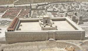
This second temple narrowly avoided being destroyed again in 332 BCE when the Jews refused to recognize Macedonian King Alexander as a god. Ptolemies ruled Judea and the Temple from Egypt after Alexander died.
Seleucid King Antiochus III defeated Egypt in 198 BCE. He prompted a short-lived rebellion in 187 when he introduced Marduk-Zeus and the Greek pantheon into the temple. Antiochus IV Epiphanes again pushed the Greek gods for the Temple and, when the Jews again rebelled and Antiochus again crushed them, he again forbade circumcision which marked Jews as followers of Enlil. Antiochus banned the Jewish Sabbath, put a statue of Zeus in their temple, and had Greek priests sacrifice pigs there. When a Greek ordered Jewish priest Mattathias to perform a Hellenic sacrifice, Mattathias killed him.
In 167 BCE the Jews rose up behind Mattathias and his five sons to fight and win their freedom from Seleucid authority. Mattathias’ son Judas Maccabeus re-dedicated the temple in 165 BCE and the Jews celebrate this event to this day as a major part of the festival of Hanukkah.
Judas Maccabaeus rededicated the Temple under Judas Maccabaeus in 164 BCE.
During the Roman era, Pompey entered (and desecrated) the Holy of Holies in 63 BCE, but left the Temple intact.
In 54 BCE, Crassus looted the Temple treasury Jews revolted again but Romans subdued them again in 43 BCE.

Herod the Great renovated the Temple in 20BCE; When Romans occupied Judea, they let Jewish priests run the Temple. Then in 70 CE, Romans destroyed the Temple.
During the last revolt of the Jews against the Romans in 132–135 CE, Simon bar Kokhba and Rabbi Akiva led another failed revolt from 132 to 135 and the Romans banned Jews from Jerusalem.
The Temple Palace, 40 cubits long, featured walls lined with cedar with carved cherubim, palm trees and open flowers overlaid with gold. Fir-wood overlaid with gold-covered the Temple floor. Olive-wood doorposts held doors, also of olive.
The Temple complex featured a large basin (called the “Brazen Sea” measured 10 cubits wide brim to brim, 5 cubits deep and with a circumference of 30 cubits around the brim, rested on the backs of twelve oxen It held 3,000 baths for the purification by immersion of the body of the priests.
FRANCE
At Carnac, in France, we see a perfect example of how these sites, shown our ancestors by the Seven Shining Anunnaki, the Followers of Horus, traversed the globe and helped survivors of the great flood of 9703 BCE build megalithic temples to remember their ancestry in the stars and their connection within to the Creator of All.

At Carnac, the Shining Ones set 4000 huge stones in thirteen parallel lines along 31 fault lines–the biggest quake fault lines in France, where the earth’s electromagnetic vibrations were greatest. The lines of highly magnetic quartz and magnetite start and end in egg-shaped rock circles “that amplify and release telluric energy throughout the day.” The alternating release and magnification create electric induction. Carnac’s menhirs–upright monoliths–are accumulators.

A man shows his height, half that of one of Carnac’s accumulator- menhirs.
Carnac’s dolmans–two or more upright stone groups–are coils.

Carnac’s stone circles were both concentrators and accumulators. The “specially-chosen rocks, high in concentrations of quartz, transported from 60 miles away are piezoelectric; they generate electricity when subject to vibrations.” And France vibrated most at Carnac. [Silva, 2012: 95 -96; https://www.youtube.com/embed/bhsZ2u3R0Ks]
BRITAIN
STONEHENGE

After Enki ordered Ningishzidda to cede Egypt to Marduk, Ningishzidda built a stone observatory at Stonehenge, a site he chose for it. Ningishzidda–the architect of the Anunnaki–gold miners from the planet Nibiru who came to Earth 450,000 years ago–built, and with Middle Eastern and Black Olmec crew from Central America, rebuilt Stonehenge II and III from 2100 and 2000 BCE on the Salisbury Plain in Britain (80 miles from London), among people who had inhabited the area since 30,000 BCE.
“Stonehenge, built initially around 2900 BCE (Stonehenge, Phase I), is the most elaborate of nine hundred ancient stone, wooden and earthen circles in the British Isles, as well as the largest and most complicated one in Europe. Stonehenge, a planned astronomical observatory” adjusted for latitude, let its builders foretell eclipses, solstices, moon phases as well as changing apparent positions of stars.


Stonehenge features thirty upright stones, of which seventeen remain: “pairs of huge upright stone blocks, each about thirteen feet high, connected at the top by a massive lintel stone to form free-standing Trilithons erected in a semicircle, surrounded in turn by a massive circle of similar giant stones connected at the top by lintels carved to form a continuous ring around the paired uprights. Inside this massive stone ring, smaller stones (bluestones) from 250 miles away over land and two miles down the Avon River from southwestern Wales, of which 29 are still there, form the Bluestone Circle outside the Trilithons and a bluestone semicircle.” “Within this second ring stood five pairs of trilithons, making up the Sarsen Horseshoe of ten massive sarsen blocks. The innermost circle consisted of nineteen bluestones that form the Bluestone Horseshoe. Within this innermost compound, on the axis of the whole Stonehenge complex, stood the Altar Stone–a sixteen-foot long dressed block of blue-grey sandstone half-buried under an upright and the lintel of one of the Trilithons.
“The rings of stone are in turn centered within a large framing circle. It is a deep and wide ditch whose excavated soil was used to raise its banks and forms an encompassing ring around the whole Stonehenge complex, a ring with a diameter of three hundred feet. “A circle of fifty-six deep pits (Aubrey Holes) surround the inner bank of the ditch. “Two stones, on opposite sides of the ditch’s inner embankment and further down the line, two circular mounds with holes in them once held stones akin to the first two stones and the four called Station Stones, connected by lines outline a perfect rectangle.


The embankment had a wide gap that opened into the concentric rings of stones, holes, and earthworks. The opening in the ditch, oriented northeast, leads to a causeway (the Avenue). Two parallel embankment ditches outline this avenue, leaving a passage thirty feet wide for a third of a mile where it branches northward toward the Cursus, an elongated earthwork at an angle to the Avenue; the other branch of the Avenue curves toward the Avon River.


A line drawn through the center of the Avenue passes through the center of the circles and holes to form the structures axis” along which are marker stones, one of which, the Heel Stone, were placed along the axis.

Some of the bluestone semicircles are missing, some lie about as fallen giants.
Stonehenge began with a ditch and a berm, an earthen circle with a circumference of 1050 feet at its bottom, twelve feet wide, six feet deep, digging up two raised banks within this outer ring of the circle are 56 pits. Ningishzidda left the northeast part of the dirt ring undug as an entrance to the middle of the circle. The two (now missing) gateway stones that flanked the entrance. The entrance stones gave the Heel Stone, a massive boulder set four feet underground and sixteen feet above on a 24 degree angle round points on which to create lines of sight down the Avenue that movable pegs set into holes on the entrance stones. Ningishzidda put four rounded Station Stones within the circle to form a perfect triangle. That was the extent of Stonehenge 1–the Earthen Ring, an entranceway axis, seven stones, and wooden pegs.
About 2100 BCE, Ninghzidda directed the Wessex people to add four-ton bluestones to Stonehenge; now called Stonehenge II. A double Bluestone Circle thus surrounded Stonehenge II. The builders shifted the Heel Stone, widened and realigned the Avenue to keep up with the changes in the Earth’s tilt made in the sunrise point. Ningishzidda and the Wessex moved the “Altar Stone” when the remodeling began.
Stonehenge III: Around 2000 BCE, Ningishzidda re-erected the Heel Stone and dug holes for new sightings. He completely dismantled the Bluestone Circle of Stonehenge II. With Anunnaki sonar technology, he brought 77 fifty-ton sarsen stones from Marlborough Downs, forty miles away. He incorporated nineteen of these bluestones in a new inner oval of stones topped by lintel stones and placed the other bluestones ready to be inserted in holes dug for two new circles (not yet completed). He replaced the old entrance stones with two huge new ones. [Time: 39 – 180]
SCOTLAND
IRELAND
NEWGRANGE (County Meath): One of Ireland’s many Anunnaki observatories, Newgrange, a large circular mound of stone with a long hall and inner rooms. Anunnaki flood survivors built Newgrange and other stone observatories in Ireland to track the moon, sun, and the precession of the equinoxes in relation to the constellation Signa (aka the Swan or Southern Cross), where they could see Anunnaki craft and Nibiru nearing Earth.

Grass grows atop the layers of earth and stones that make the Newgrange mound. The mound measures 249 feet across and 39 feet high. Inside, a hallway of large stone slabs engraved with star maps stretches 60 feet to three small chambers off a larger central chamber with a high corbelled vault roof.


Each of the smaller chambers has a large flat basin stone. Once a year, at the winter solstice, the rising sun shines directly along the long passage and lights up the inner chamber and, for seventeen minutes, sunlight enters the passage through a specially contrived opening, known as a roof box, directly above the main entrance.
Sunlight focuses on a triple spiral star map on the front wall of the chamber.

SOUTH AMERICA
13,000 years ago Earth’s climate deteriorated in the run-up to the perigee of 10,500 years ago that caused Noah’s flood. Enlil, Commander of the gold mining expedition from the planet Nibiru to Earth (the Anunnaki), ordered a second interplanetary spaceport atop the Andes, where his son Adad had built a landing platform around 15,000 BCE [Lost Realms: 222]. Enlil wanted the second rocket base in case of Marduk and his ex-astronaut allies (the Igigi) overran the Sinai rocket port that Enlil’s grandson Utu ran.
Enlil, under orders from his father, King Anu, back on Nibiru, expected to return to Nibiru with the Nibirans he commanded as well as enough gold to powder into Nibiru’s atmosphere to protect it from destructive dissipation.
Enlil warned Anu that Marduk, the son of Enlil’s rival, Chief Scientist Enki, had created alliances not only with the ex-astronauts but also with the hybrid Erectus-Nibiran Earthling miners and slaves Enki had made from the Nibiran genome. Marduk and his allies, Enlil and Anu realized, could push the claim of Marduk to rule Nibiru by dint of the treaty Anu had sworn with Marduk’s mother’s father, Alalu, Anu’s predecessor on the Nibiran throne.
PUMAPUNKU
Enlil sent his youngest son, Adad-Viracocha, and Adad’s older half-brother General Ninurta to the Andes to scout out a potential second spaceport. They found their ideal site at Lake Titicaca, Earth’s highest (913,861 feet) lake–perfect for boats–20 by 44 miles large, 100 -1000 feet deep and dotted with over 41 islands.

Waters running from the lake gave the Anunnaki placer gold and cassiterite tin and bronze for their European and Middle Eastern centers. The Desaguadero River flows from the southwest corner of Lake Titicaca into the satellite lake, Lake Poopo, 260 miles to the south; “there is copper and silver all the way to the Pacific Coast, where Bolivia meets Chile.” [Lost Realms: 242 – 243]

A moat surrounded Pumapunku and connected to a canal system that ran to lake Titicaca, fifteen miles away through the level ground. Upheavals, probably from the same disturbances that caused the destruction of the Nile area that Moses, whom Enlil forewarned, from the nearing of Nibiru or its Lagrange points in 1450 BCE, destroyed the huge landing platform and scattered its H-shaped 400-ton twelve by ten by two-foot thick red sandstone blocks that Adad had quarried ten miles from Pumapunku.

“A destructive wave of water from Lake Titicaca violently destroyed Pumapunku and Tihuanacu to the south of the lake.” People “on the edge of Lake Titicaca (12,500 feet up) felt impact shockwaves generated by incoming aerial projectiles breaking bulwarks on the lakes, causing the release of an unstoppable wall of water that overwhelmed the temple city of Tiwanaku, tossing its megaliths, crushing and jumbling its inhabitants along with fish and marine life, mammals, utensils, jewels, pottery and shells into one heap. [Missing Lands: 28; Childress, 2012:107, 177]

“The stones at Pumapunku interlocked by grooves and articulated notches in the edges of the stones and cemented together by keystone cuts and bronze clamps.” [Childress, 2012: 105; Lost Realms: 211]
Adad’s workers survived Noah’s flood on Titicaca and the Coati Islands in the sheltered southern portion of the lake.

Adad and his Sumerian foremen had them build, 1/4 of a mile from Pumapunku, Tiahuancu, aka “Tin City,” [Anuku = “metal granted by the Anunnaki.”] a two-square-mile city, metallurgical, temple, and observatory complex powered by electricity, on the shore, and with subterranean chambers. Tin supplies had run out in Europe after 2600 BCE, then Adad’s Cassites [Kosseans] Earthlings, related to the Hittites and Hurrians, flowed vast amounts of tin from South America to the Near East. [Lost Realms: 243 -245]
The Anunnaki employed “portable power plants” and “rotating magnetic fields” that gave Tiahuanacu AC power.” They “set up hydroelectric or wave stations to generate a large amount of power to send via microwaves to satellites and then redirect them to the remote parts of the earth as a form of usable power.” They sent cargos of precious metals and dried or honey-packed psychedelic mushrooms around the world. [Childress, 2012: 151]
The Anunnaki smelted, at high temperature, alloys including platinum and extracted mercury from mineral cinnabar. They used mercury to extract nearby silver. They built also an underwater city, Huanacu, some 80 feet down, hewn into the northern side of Titicaca Island. Tiahuanacu’s “builders planned Tiahuanacu in advance, with diverted rivers, water reservoirs on the top of pyramids (on or in which water washed ores) and massive stone [refining] structures with gigantic solid-stone doors. Pumapunku, the original New World El Dorado-Ophir city (the one to which Israel’s King Solomon flew over the Pacific from the Java Sea) featured gigantic walls covered in sheets of gold, golden masks, sun disks, gold-woven tapestries and drill holes to attach sheets of gold and other gold items.”

Nearby, Bolivians gathered the Fuente Magna Bowl, which bore ancient Sumerian cuneiform writing circa 3000 BCE and the Aymara language that the descendants of Ka-in developed from Proto-Elamite or Akkadian [Childress, 2012: 86, 109, 129 – 131, 146,150].
Tiahuanacu set off Pumapunku with a grand gate, the “Gate of the Sun,” originally a doorway for a solid granite door to for a nine-foot-tall person or a person with an elaborate headdress.


The door led to a smashed 400 by 450-foot rectangular astronomical observatory called the “Kalasasaya,” that a moat had surrounded. The building, like a similar building at Pumapunku, had been destroyed and the door frame moved to form an arch leading to Pumapunku.

The Nibirans cut and shaped the gate as it stood in Tiahuanacu from a single hundred-ton, 10 x 20 foot stone block that features a carving of Adad, with golden tears. Tears, which represent the molten gold, tin, iron, platinum, and mercury Tiahuanacu refined, run down his cheeks. The statue wears an elaborate headdress and holds Adad’s symbol, the forked lightening the zodiac of Sumerian Anunnaki. Reliefs of 30 “birdmen” on Adad’s right–probably Nibiran astronauts–run toward him; one of these holds the trumpet-like object the Anunnaki used to move large stones.

After the building that contained the gate broke apart, the Anunnaki reconstructed it and incorporated as an arch to Pumapuku for a pilgrimage site for Andean “Indians.” Next to the gate stands a wall into which the builders sculpted heads of the various Earthling and ET types that visited the site [Childress, 2012: 88; Lost Realms: 210, 216 -217].
Relief on the Pumapunka wall (left) looks like contemporary Grey (Right).
Around 3800 BCE, Nibiru’s King Anu and Queen Antu flew with their grandson, Ninurta, from Sumer to the Tiahuanancu where a gold-plated enclosure (held together with solid gold nails) he and Adad had built awaited them. They saw the Spaceport on the 200 square-mile Pampa plain below where. On the runway, “Anu and Antu’s celestial chariot stood ready, with gold to the brim it was loaded.” Anu pardoned Marduk tor his last offensive against Enlil, then the King and his Queen rocketed off to Nibiru, then to Mars, then to Nibiru. Enlil ordered Adad to guard the Enlilite South American facilities against Marduk while he and the other Nibiran Earth Mission leaders returned to Sumer. [Enki: 272-276, Lost Realms: 255; Journeys: 206]
By 2200 BCE, as supplies of tin for bronze dwindled in Europe, Adad sent tin aplenty from Tiahuanaco back to Sumer, through his Hittite-Cassite subjects in Turkey. Descendants of these Middle Easterners still dwell on Titicaca and Coati Isles. Tiahuanaco, after most of the Anunnaki, returned to Nibiru, became a pilgrimage site for the growing “Indian” population. There, Adad directed the construction of Mochica, Chan-Chan, Cuzco, Macho Picchu, Chavin, Ollantaytambo, and tutored a couple he chose to create Machu Picho [Time: 247].

From Lake Titicaca and Tiahuanacu in Bolivia and Peru’s south, Anunnaki spread megalithic culture–landing platforms, metallurgical plants, pyramid power plants, astronomical observatories, palaces, canals, homes, statues, city walls, roads, bridges, and quarries. Everywhere they settled, they left deep, extensive tunnels that moderns have not yet explored. Anunnaki culture spread North into ancient, pre-Inca Cusco, Ollantaytambo, Machu Pichu, and Chavin. The Anunnaki mined copper and gathered gold and alluvial cassiterite–oxidized, water-washed tin from the Eastern coast of Lake Titicaca and the Lake Poopo area southeast of La Paz (down the Desaguardero River from Tiahuanacu).
Anunnaki brought successive waves of descendants of Ka-in, the South American Indians to coastal settlements along the Peruvian coast. At Paracas Bay, Adad blasted a huge image of his metal tool with its forked lightning to welcome incoming boats and aircraft from the Pacific.
PERU
MACHO PICHU


OLLANTAYTAMBO

Ollantaytambo’s 637 km (miles along the Urubamba River from Tiahuancu (roads and air route erased)

Ollantaytambo rests 637 km from Pumapunku, 45 miles north of Cuzco. Ollantaytambo lies northwest along the Urubamba, on an exact 45-degree angle line between the Titicaca Island off Tiahuanacu and the Equator. “A 45-degree line originating at Tiahuanacu, combined with squares and circles embraced all the key ancient sites between Tiahuancu, Cuzco, and Ollantaytambo.” Earth’s tilt (obliquity) when the Anunnaki laid out this grid was 24 degrees, 08’ in 3172 BCE, the Age of Taurus [Enlil’s Age] between 4000 BCE and 2000 BCE.” [Lost Realms: 199 – 205]

Ollantaytambo, a landing platform (probably for the gold refinery at Sacashuaman, 60 miles to the southeast) rests “atop a steep mountain spur” and overlooks “an opening between the mountains that rise where the Urubamba-Vilcanota and Patcancha rivers meet.”
On the summit “megalithic structures begin with a retaining wall built of fashioned polygonal stones.

Through a gateway cut of a single stone block, one reaches a platform supported by a second retaining wall of polygonal stones of a larger size. On one side, an extension of this wall becomes an enclosure with twelve trapezoid openings–two as doorways and ten false windows. On the other side of the wall stands a massive gate to the main structures.” The Anunnaki channeled a stream through Ollantaytambo’s structures. Childress suggests Ollantaytambo featured a control building for an airport below the plaza along the river. [2012: 315]


“A row of six colossal monoliths stand on the topmost terrace. The gigantic stone blocks are from eleven to fourteen feet high, six or more feet in width and vary in thickness from three to over six feet. These 50-ton or so blocks stand joined together without mortar with long dressed stones inserted between the colossal blocks to create an even thickness. The megaliths stand as a single wall oriented southeast. One of the monoliths touts a relief of the “Stairway symbol” of Tiahuanacu” that shows the connection between Earth and Sky.
Something interrupted Ollantaytambu’s construction; “stone blocks lie strewn about,” with T-cuts for poured metal clamps in them to hold the blocks together during earthquakes. The clamp-cuts duplicate those at Tiahuanacu. “A levitation device made the stones leap down the road from the quarry to slides, where the stones would be pushed over the edge and retrieved at the bottom. They would again be made to jump to the river and across, then up to the plaza. During this process, certain stones were “lazy” and could not be made to jump properly and were therefore abandoned.” [Childress, 2012: 303]

The Anunnaki carved huge blocks of very hard red [porphyry] granite that holds large-grained quartz crystal, from Kachiqhata, the opposite mountainside of Ollantaytambo’s valley. There builders hewed and shaped the blocks, then, with inverse piezoelectricity, moved them over two streams to slides on each side of the rivers, then up to Ollantaytambo where they raised, precisely placed and fused the blocks together. Though they brought many blocks across the river, the builders left 40 or more on the river’s eastern side. [Childress, 2012: 259 – 303; Lost Realms: 199 – 205]
MACHU PICCHU (Tampu-Tocco)


On the eastern slope of the Andes, 7,585 feet above the sea, Machu covers 32,500 hectares4,000 feet above a bend in the Urubamba River, “which forms a horseshoe gorge half encircling the city’s perch, 75 miles northwest of Cuzco. Machu “was situated to control access to Ollantaytambo and Tiahuanacu.
Machu Picchu “first served as a model for Cuzco, then emulated it.” Both Machu and Cuzco “consisted of twelve wards, royal-priestly groupings on the west and residential-functional ones occupied by the Virgins and clan hierarchies on the east separated by wide terraces. Common people tilled and cultivated the mountainsides. They lived outside the city and in the surrounding countryside.”


“Royal residences are built of ashlars [squared facing stones] laid in courses, finely cut and dressed.”
In the most ancient area, the Temple of Three Windows, Sacred Plaza [landing platform?], and Principal Temple display huge, precisely-cut stone blocks locked together without mortar.
“One of the stones has 32 angles. Cutting, shaping, and angling of the hard granite stones was as though they were soft putty. White granite stones had to be brought from great distances, through rough terrain and rivers, down valleys and up mountains.
“The Temple of Three Windows has only three walls” and on its open, western side” faces a 7-foot tall pillar for “astronomical sighting purposes.


“The Principle Temple too has only three walls, some twelve feet tall. The western wall is constructed of just two giant stone blocks held together by a T-shaped stone.”

A huge monolith, fourteen by five by three feet, rests against the north wall of the main temple.

The Intihuatana:
“Winding steps lead from the northern edge of the Sacred Plaza up a hill whose top was flattened to serve as a platform for the Intihuatana, a stone cut with precision to measure the movements of the sun, determine the solstices and make the sun return, lest it return the Earth to the darkness that occurred before.”

The Torreon:
“At the end of the western part of Machu Picchu, the semicircular Torreon is built of ashlars “creates its own sacred enclosure at the center of which there is a rock that’s been cut and shaped and incised with grooves” like the rock in Jerusalem’s Temple Mound and Mecca’s black stone.
The Cave:


Beneath Machu, lies a huge cave “enlarged and shaped artificially to precise geometric forms, the masonry of white granite ashlars. This is the cave from which the Anunnaki sent the first Inca king to found Cuzco, 75 miles southeast of Machu. [Childress, 2012:319 -343; Lost Realms 140 – 154]
CUZCO

Cuzco, which theAnunnaki built sometime after Noah’s Deluge of 10,500 BCE, sits on a promontory called Sacshauman (11,500 feet above sea level) that rises above the Tullaumayo and Rodadero Rivers. The site panned gold and featured aircraft landing facilities.

Cuzco’s “older edifices were built of perfectly cut, dressed and shaped stones of brown trachyte, stones of great size and the oddest shapes that fitted one into another’s angles with precision and without mortar.”
Some of Cuzco’s megalithic stones had been melted with added oxygen in temperatures over 1,100 degrees. This glazed their silicate surfaces, so the “surfaces even if irregular, feel smooth to touch.” The builders put each newly placed but still hot stone next to stones already cool and hardened prior-placed jigsaw polygonal blocks. The new, just-placed stone stayed fixed in perfect precision against the hardened stones. The new stone became its own separate block of granite, which would then have more blocks fitted into their interlocking positions in the wall. [Childress, 2012: 249]
Sacsayhuaman

The Saschuaman promontory, “shaped like a triangle with its base to the northwest,” rises eight hundred feet above the city below. Gorges form Saschuaman’s sides and “separates it from the mountain chain which it rejoins at its base.”

Tunnels, niches, and grooves perforate huge rock outcroppings, cut, and shaped into giant platforms. Siphon-fed aqueducts channeled water to wash ores. Childress speculates that one of the tunnels connects Cuzco with Tiahuanacu, though moderns who explored the tunnels never returned to the surface. “Cuzco started out as a mining camp and processing area, then became a temple.” [Childress, 2012: 246]
A flattened area, “hundreds of feet wide and long”–probably an aircraft landing strip marks the promontory’s middle. From here, aircraft lofted away from the nuggets the structures panned. “The narrower edge elevated above the rest of the promontory contained circular and rectangular structures under which run passages, tunnels, and openings beneath a maze cut into natural rock”–all part of Cuzco’s gold-panning operation.

Three massive walls of massive stones “rise one behind the other, each one higher than the one in front of it to a combined height of sixty feet.” The walls run parallel to each other in a zigzag” and protect this area from the rest of the promontory. Earth-fills behind each wall created terraces. The lowest first [Anunnaki-built] wall, built of colossal boulders” weigh ten to twenty tons, many fifteen feet high, fourteen feet long and thick.” One of these boulders in this wall reaches “twenty-seven feet tall and weighs over 300 tons. As in the city below, faces of these boulders have been artificially dressed to perfect smoothness, beveled at the edges. The massive blocks lie atop one another, sometimes separated by a thin stone slab.
Everywhere the stones are polygonal, odd sides and angles fitting without mortar into the odd and matching shapes of the adjoining stone blocks. Larger blocks were Anunnaki; smaller stones, Incan.


The builders quarried the gigantic stone blocks miles away and moved them “over mountains, valleys, gorges, and streams.” At the center of the front wall, the Gate of Viracocha made a four-foot opening. “Steps then led to a terrace between the first and second walls from which a passage opened against a transverse wall at a right angle” and led to the second terrace. There two entrances at an angle to each other led to the third wall” and “could be blocked by lowering large, specifically fitted stones into the openings.
On a nearby plateau, Sitchin noted a cut rock that once held “a mechanical contraption.”

Bed for the mechanical tool at Cusco [Lost Realms: 129]
“Walls, conduits, receptacles, channels form a series of water-channeling structures one above the other; rain or spring water could flow from level to level. A huge circular area enclosed by megalithic ashlars lies underground at a level permitting the running off of the water from the circular area–a large-scale gold-panning facility. The water was flowed off through the sluice-chamber and away through the labyrinth. In the stone vats, what remained was gold.”

“Facing the cyclopean walls across the wide-open flat area, the Chingana (labyrinth), a cliff whose natural features have been artificially enlarged into passages, corridors, chambers, niches, and hollowed-out spaces” featuring “rocks dressed and shaped into horizontal, vertical, and inclined facings, openings, grooves cut in precise angles and geometric shapes, holes drilled down.”
Sitchin shows how it had to be the megalithic builders of Tiahuancu, rather than the very recent Incas, that built Cuzco, long before Inca times. “One of the Inca master masons decided to haul up a stone where the original builders had dropped it. More than 20,000 Indians, dragging it with great cables.” But the rock rolled down the slope and killed four thousand Indians.” Coricancha The Coricanchais [conflated into the “Temple of the Sun” by the Spanish] an Anunnaki temple of which a semicircular wall survives, Sitchin wrote, honored Adad.
The Coricancha adjoined auxiliary temples for Nannar, Inanna, and other Anunnaki. Next to an enclosure, the Ancilla-Huasi, we see “a secluded enclave where virgins dedicated to the Great God lived.”[Childress, 2012: 209-254;Lost Realms:120 – 131]
From South America, Ningishzidda surveyed Yucatan and the Valley of Mexico for gold and then brought his Olmec and Sumerian aides to organize Indians to mine and refine gold, silver, and other minerals. [Lost Realms: 237 – 250]

CHAVIN DE HUANTAR
The nation of Chavin appeared suddenly, around 15000BCE or Earlier.” The main city, Chavin De Huantar–probably a ceremonial center– sits “at an elevation of 10,000 feet in the Cordillera Blanca range of the northwestern Andes of northern Peru between the coast and the Amazon basin.


There in a mountain valley where tributaries of the Maranon River form a triangle, an area of 300,000 square feet was flattened and terraced for complex structures precisely laid out.

Buildings and plazas form precise rectangulars and squares aligned with east-west as the major axis.” The builders “ingeniously used the two levels of the tributaries to create a flow for panning gold. The site once held ultramodern machinery.

The site yielded artifacts with motifs from Ninishzidda’s Mayans as they retreated south –jaguars, condors, entwined fangs–Egyptian motifs–the Eye of Marduk/Ra, serpents, pyramids–Mesopotamian motifs–winged disks, Anunnaki headdresses, and trophy statues of Sumerians in pain– and portraits of black African Olmecs holding mining tools.


![Figure on top's bearded, not Native American. Lower left--an Olmec; Lower right, a "giant" with a weapon or tool. (Lost Realms: 192]](https://i1.wp.com/enkispeaks.com/wp-content/uploads/2014/09/Olmecs-Mesopotamians-at-Chavin-Lost-Realms-page-1921.jpg)
Figure on top’s bearded, not Native American. Lower left–an Olmec; Lower right, a “giant” with a weapon or tool. (Lost Realms: 192]
A nearby site Peruvian site shows Gilgamesh of Uruk, Sumer, in Mesopotamia, wrestling two lions–good evidence of the same people inhabited both places.

The Sumerian trophy statues show straight-nosed Indo-European men from “Asia Minor, Elam, and the Indus Valley, the “giants” with metal tools–perhaps part of two invasions, one by Naymlap who landed at La Plata Island and Ecuador. Inca histories say Adad and his Sumerian assistants massacred these newcomers.
The three main buildings rose from terraces that elevated them and leaned them against a forty-foot high outer western wall that ran 500 feet and encompassed the complex on three sides and left the site open to the river on the east side.
The southeast corner building– the site’s largest (240 x 250 feet in area)–rose three stories made of smooth-faced incised masonry stone blocks. “From a terrace on the east, a monumental stone stairway led to a gate up to the main building.” Two cylindrical columns flanked the gate. “Adjoining vertical stone blocks supported a thirty-foot horizontal lintel made of a single monolith. A double stairway led to towers atop the building.
Steps led from the eastern terrace at Chavin De Huantar to a sunken plaza surrounded on three sides by rectangular platforms. A large flat boulder with seven grind holes and a rectangular niche stood “Outside the southwestern corner of the sunken plaza.”
The three buildings featured corridors and inside maze-like passages, connecting galleries rooms and staircased faced with decorated stone slabs. The stone slabs that roofed the passages set to support the buildings.
The Tello Obelisk


This monolith in the main building engraved Chavin’s tales of figures with “human bodies and faces with feline hands, fangs or with wings” as well as animals, birds, trees, gods emitting rocketlike rays, and geometric designs.”
The Raimondi Monolith

A seven-foot carved stone on the southwestern edge of the sunken plaza, probably Adad with his thunderbolt and his cult animal, the bull of his grandfather, Enlil.
El Lanzon


This stone column, inscribed with Adad’s bull, in the Chavin De Huacar’s middle building sticks through a hole in the floor above it. [Lost Realms: 184 – 196]

Paracas Bay
Behold the feet-deep ’Candelabra’ in nearby Bay of Paracas, Peru, a symbol of Adad-Viracocha, the Great God of South America.
 Candelabra, Adad/Viracocha’s trademark, Bay of Paracas, Peru
From South America, Ningishzidda surveyed Yucatan and the Valley of Mexico for gold and then brought his Olmec and Sumerian aides to organize Indians to mine and refine gold, silver, and other minerals. [Lost Realms: 237 – 250]
CHINA

PYRAMIDS
Pyramids flattened on top for aircraft landing abound in northern and central China’s (though China’s bosses hide this) rival Egypt’s and Central America’s for age–12,000years ago–and size.
CAMBODIA
Angkor Wat’s huge city complex centers about a square (5,000 feet by 4,000 feet), walled, moated temple.* The temple sits atop an ancient Anunnaki landing platform, power station, and metallurgy plant. The temple complex features red sandstone paved causeways “lined with stone figures who pull a hooded serpent.” The moat is 623 feet wide, the walls on each side, a mile long. Within the walls, paved courtyards join three galleries. A large tower caps the highest, center gallery.
Before the worldwide Deluge of 11,000 B.C., Preah Pisnokar, a part-Earthling, part-Anunnaki, built a landing-platform, power station and gold-processing plant at Cambodia’s Angkor Wat. He built Angkor with advanced technology from Nibiru, the planet of his mother. Preah and later kings reduced local sandstone to a slushy concrete.
They poured the sandstone concrete into molds that formed continuous mile-long walls on four sides of the temple complex. The walls nestle within a canal that surrounds the temple.
Preah poured “magical water onto the stone, which made the stone into concrete which hardened in place as blocks in the structures of Angkor. He probably used technology Dunn proved in Egypt’s Giza Pyramids. Angkor generated power as part of a worldwide grid Anunnaki pyramidal power stations and monoliths that accessed and augmented power for aircraft, communication, lighting, and computing.
Here’s how the Anunnaki, and probably Angkor’s builders, generated power. From the canal around Angor’s walls, they piped water into a stagnant pool under pyramids. They pressured the stagnant pools with pumping and/or sonar devices. This created a powerful vibration moving up the structures. In sealed chambers above the vibrations from the pools, they exploded hydrogen (from hydrochloric acid they mixed with hydrated zinc). [Dunn, C., in http://enkispeaks.com/2013/12/20/mars-and-earths-pyramid-parallel-power-stations-statues-spaceports/]
RAPA NUI (Easter Island)
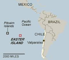
Anunnaki built a settlement on Easter Island (Rapa Nui). They considered Easter a “naval of the Earth”, along a line of settlements from Eurasia to a landing platform Yahweh-Enlil had his sons Princes Ninurta and Adad-Viracocha build 13,000 years go at Pumapunku and Tiahuanacu on the shores and under Lake Titicaca atop the Andes. To make the platform, Ninurta and Adad-Viracocha used the same sonar technology they’d used in South Africa, Turkey and Iraq. The line of settlements across the Pacific and the Western Hemisphere featured statues of the bearded Viracocha-Adad.
The Anunnaki princes brought descendants of Cain from southeast Asia with them as laborers. Ninurta and Adad were bearded; Cain’s descendants were not, for the Anunnaki Council had ordered Cain’s issue beardless as a genetic marker for Cain’s murder of his twin Abael. Statues of the bearded Viracocha adorned the Pacific and South American settlements whose laborers were beardless “Indians’ of South America and Pacific Islanders, such as the Easter Islanders.
Yahweh, under orders from his father (King Anu back on Nibiru), expected to return to Nibiru with the Nibirans he commanded as well as enough gold to powder into Nibiru’s atmosphere to protect it from destructive dissipation. Yahweh warned Anu that Satan created alliances not only with the ex-astronauts but also with the hybrid Erectus-Nibiran Earthling miners and slaves Satan’s father, Chief Scientist Lucifer (Enki), had made from the Nibiran genome. Satan and his allies, Yahweh and Anu realized, could push the claim of Satan to rule Nibiru by dint of the treaty Anu had sworn with Satan’s mother’s father, Alalu, Anu’s predecessor on the Nibiran throne.
Silva writes, “Two thousand miles separate the cities of Tiawanaku [sic], Pisac, Cuzco and Machu Picchu”-all the post-Deluge Followers of Horus defined as Navels of the Earth–from Navel monuments of Easter Island. Yet the same culture of light-skinned, red-haired, and bearded. “Features link the antediluvian gods–based on testimonies from the oldest of cultures from the Andes through the Pacific to Egypt. The bosses of these settlements were tall people with light skin, red or blonde hair, and elongated skulls with a 25% greater cubic capacity than homo sapiens.
“A description from the Cook Islands calls them Maori, meaning ‘white-skinned travelers’. Their given nickname, Shining Ones, is common to Mesopotamia, Egypt, Easter Island and the Lake Titicaca region.
“Hair sequencing links them to a genetic group originating in southeastern Europe, particularly the Black Sea and the Caspian Sea region, just north of Armenia. Mitochondrial DNA reveals mutations unknown in any human, primate, or animal. They were literally a race apart [Silva, https://invisibletemple.com/book-the-missing-lands-freddy and The Missing Lands:79]
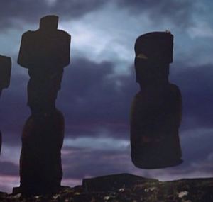

On Easter Island (Rapa Nui), a native informant told Ancient Aliens [Season 3, Disk 2, 44:53] that a god, wearing an Eagle Helmet (helmet of the Nibiran Astronaut Corps [Nephilim Igigi]) transported the huge statues (moai) through the air to their platforms (ahu) on the hill. As at Baalbek in Lebanon and in the stone lanes of South Africa, the Anunnaki who placed the statues used a stone [called, on Easter “The Golden Navel Stone”] enabling the stones to be lifted and making them appear as though walking through the air to their locations during a single night.”
Here’s Michael Tellinger’s expo on how the Anunnaki used sound to move heavy rocks:
“Over 100 ceremonial platforms and over 1000 statues like the ones you see here spread over Easter Island.” Some of the statues were placed on the platforms. Others, along the slopes of Rano Raraku volcano, were covered up to their necks in sediment. Excavation of one statue revealed the head to be attached to a long torso, making the statue over 40 feet tall. “The statues “were carved by different people over different epochs. Younger statues are shaped from available volcanic turf. Older statues are carved from tougher basalt and are found at deeper stratigraphic levels or beneath the newer statues and their platforms.” Polynesians from the Pacific Isle of Tongareva, “whose ancestors once lived on Easter Island say the bearded effigies represent the visiting Skywalkers; later Statues represent the Chiefs of Easter. Bearded dudes weren’t indigenous here; they came from Eurasia. The Ears of Easter’s statues are elongated, their arms reach around their protruding bellies “to hands with slender, outstretched fingers spread around a navel. The statues’ symbolism commemorates Easter Island as a birthplace.
The older platforms were built from basalt, which is absent from the surface of Easter and absent from platforms and statues built after the flood of 13,000 years ago. But “Jacques Cousteau found rectangular cavities in basalt layers on ledges below sea level” so “the basalt must have been extracted when the quarry was still accessible when Easter Island was considerably larger and part of an archipelago stretching several hundred miles. Easter was crisscrossed by roads leading to the edge of the sea, into which they disappear.
“The first survivors to reach Easter Island after Noah’s flood came from a [now sunken] island named Hiva” [song]. The Seven Anunnaki post-deluge sages brought 300 men to help fashion the platforms for the statues. [Missing Lands: 80-84]
HAWAII
Hawaiians consider the Volcano atop Moana Kea a sacred site. The locale of this volcano is on the hotspot that occurs throughout planets in our solar system. The energy/spirit that emanates from such spots evokes spiritual experiences in those who reflect at these places.
In South America, Ningishzidda and his Uncle Adad directed the construction of Mochica, Chan-Chan, Cuzco, Macho Picchu, Chavin, Ollantaytambo, and “the Baalbek of the New World”–a metallurgical, temple, and observatory complex at Tiahuanaco, Peru.

YUCATAN
Itza
After Enlil nuked Sinai and radiated Sumer in 2024 BCE, Ningishzidda and his team–Anunnaki assistants, Black Olmec, and bearded Mesopotamians–brought descendants of Ka-in (“Indians” to American Anthropologists) across the Atlantic to Yucatan and then to Teotihuacan in the Valley of Mexico. In both Central America’s Yucatan and in the valley of Mexico, the Anunnaki team first built their megalithic pyramidic power stations, then had their Indians built megalithic structures and statues. In Yucatan, the Maya, guided by Olmec technicians and Sumerian overseers, built (at Dzibilchaltun, Palenque, Tikal, Uxmal, Izamal, Mayapan, Chichen Itza, Copan, Tolan, and Izapa) huge stepped-stone temples like Sumer’s. [Lost Realms: 86 – 110]
The Olmec-Maya culture spread across Central America and into the Valley of Mexico till Ningishzidda* left them in 311 BCE, when he said he’d return December 21, 2012, with other Anunnaki, to wrest control of Earth from its current matrix of war, miscegenation, and debt-slavery. [* Ningishzidda’s also known as Hermes, Thoth, Votan, Quetzalcoatl, Kukuklan, Itzmam, Mercury.]
Olmec structures appeared suddenly throughout Yucatan, without prior development. The ceremonial center at Itza aligned with three-mile markers along a north-south line. Heads were buried around 1 CE as Olmecs retreated south. Pyramids laid out south to north to allow transit-sightings.
Toltecs moved to Itza after they left Tolan, near Mexico City. Toltec pyramid to the Plumed Serpent reaches 185 feet high; it duplicated the pyramid the Toltecs left at Tula.
Toltec centers in the Yucatan featured ballcourts where opposing teams enacted the astronomical events depicted in the Anunnaki account of Earth’s creation. Toltecs beheaded the losing captain of the losing team to mimic how Nibiru, the Anunnaki home planet, decapitated Tiamat, the Proto-Earth.
The Maya decorated the main ballcourt at Chichen Itza “with scenes of the Sumerian Tree of Life and the standard winged and bearded Anunnaki.”

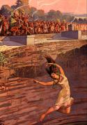 Maya, at urging of priestly caste Ningishzidda left to rule them, cast virgins into the sacred well.
Itzas mined. They employed cutting tools and lights for their mines. They–perhaps after Ningishzidda left them–threw maidens as well as mirrors, gold, silver, refined tin and bronze ornaments engraved with bearded Mesopotamians and Anunnaki gods [Itzas were beardless descendants of Ka-in] into the well.
Olmec ponds connected thru subterranean conduits.
Itza statues had glyph writing and calendar starting 3113 BCE. Their engravings showed miners and metalworkers with tunneling and metalworking tools [metal-cutting flame thrower], as well as Anunnaki flight (Winged people).
Archeologists unearthed sixteen buried massive stone Negroid heads the Olmec’s had moved through over sixty miles of jungle and swamp. The buried heads measured “5 10 feet high, 21 feet in circumference and weighed up to 25 tons. The Olmec, as they retreated south to survive Indian attackers, buried the stone heads.[Lost Realms: 86 – 110]
“Maya cities were open-ended ceremonial centers surrounded by a population of administrators, artisans, and merchants supported by an extensive rural population. “From a base abutting the Gulf of Mexico, the cities of La Venta, Tres Zapotes, and San Lorenzo formed the area of Olmec settlement and cut southward toward the Pacific Coast of Mexico and Guatemala. By AD 900 the realm of the Maya extended from the Pacific Coast to the Gulf of Mexico and the Caribbean. Mayan civilization spread “southward across Mesoamerica by 800B.C.. Thoth organized the Maya into four domains, 4 parts, each with a capital. Palenque was the capital of the West, Calakmul was the capital of the North, whose rulers conquered Palenque. Copan was the capital of the South and Tikal, the East.

Palenque with plumbing

Palenque ruin with written history carved in stone
 Copan
Copan

Calakmul
From Palenque, a focus on the twelve-foot king buried under a pyramid:


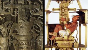

Mayan Astronaut Lord Pacal Closeup showing exhaust flames
Ancient Aliens illustrates exhaust from Lord Pacal’s rocket
![Tsoukalo's display of probable source of the Mayan, Indian and Chiese saw as a dragon or plumed serpent: Anunnaki rocket. [Ancient Aliens, Season 4, Disk 1]](https://i2.wp.com/enkispeaks.com/wp-content/uploads/2013/03/Rocket-Mayan-PupucanQuetzlcoatl-opening-up-Maya-Zig-in-back-AAs4d1-06.jpg?resize=300%2C248)

Kukulcan emerges from rocket
Itza and the other Mayan centers featured ballcourts where Celestial Battle acted out by opposing teams. Losing captain decapitated, enacting, Sitchin suggests, how the Anunnaki home planet, Nibiru, decapitated Tiamat, the Proto-Earth.
Ningishzidda tutored the Maya in both phonetic and character writing; they manufactured ink and paper books. The Maya produced monumental sculptured art, carved jade, hand-held lights, weapons, flamethrowers, and tools fitted with mirrors. Thoth taught them the principles of place value and zero which let them, with the advanced astronomy he dictated, so they could know when Nibiru neared Earth and when Nibiran “gods’ came and went.
He showed them how to make calendars that showed Venus circled the sun every 6000 years. Thoth also taught the Mayans the more-than 26,000-year Precession of the Equinoxes on Earth.
He showed them how to make and use telescopes, and had astronomer apprentices raised in the dark to better see the heavens through the telescopes. The accuracy of their predictions over time validates Nibiran presence and influence on Earth. [Tsarion, M., 2012]
Thoth left Earth. He said he and his father Balam Yokte (Enki) would return on December 21, 2012, and challenge the forces of evil on Earth. Thoth and his accompanying Nibirans “left, presumed to be swallowed by the ruler of the night, the Jaguar; and the image of Thoth was henceforth covered by the jaguar’s mask through which serpents, his symbol, emerge.”
Bolam Yakte is Enki/Ptah/Lucifer

Kukulcan Emerging from Flying Serpent craft


The night (jaguar) eats Kukuklan
Priests encouraged blood sacrifice, ostensibly to bring back the gods, but then to execute prisoners and control people. Kings and Priests kept blood sacrifice–at first those of rulers, then of enemy rulers, then anyone they needed to control.

Mayan priests ask Kukuklan to have a heart and return
CHICHEN ITZA

Chichen Itza Mexico

From 1000 to 450 B.C., Chichen Itza, near where Thoth first landed in Yucatan, became “the principle sacred city of Yucatan.
Chichen Itza by 450BC, “the principle sacred city of Yucatan,” boasted a sacred well. The Itzas, migrants from the south, built their ceremonial center–the great central pyramid and the observatory–near where Thoth first came ashore in Yucatan. The Toltecs, who had migrated from central Mexico, gradually populated Teotihuacan, then migrated south to Chichen Itza, to be near the place Thoth came ashore and would return.
At Chichen Itza, the Toltecs reproduced sculptures of the Sumerian stories of the Celestial Battle including the astronomical events that killed Tiamat, the proto-Earth, and resurrected Tiamat as Earth. The art shows the exact position of the Earth from the outside to the inside of the inner solar system. They built a 9-stage pyramid dedicated to Thoth, decorated with carvings of him. The decorations incorporated in its structure calendrical aspects and duplicate the pyramid in Tula, the capital of the Toltecs from Teotihuacan.
Toltecs, in the sacred well at Chichen Itza, threw 40 virgin girls as sacrifices, as well as gold, silver, and copper ornaments made from metals refined from ores Mesoamerica lacked. Art on the ornaments showed bearded Sumerian types, as well as Sky Gods [Nibirans].
The Olmecs gradually retreated south as Indians moving down from the North attacked them. Olmecs first fled their older metropolitan center near the Gulf, circa 300 BCE. They gave up their more southern centers last. The Indians killed both negroid Olmecs and the Bearded Ones,” from the Eastern Mediterranean.”
MEXICO
Teotihuacan
Around 28,000 years ago, an Anunnaki computer guided Mayans (who came to be known as Toltecs and Aztecs) from a place they called Aztlan in Guatemala to the Valley of Mexico where they built Teotihuacan, their capital.
Anunnaki traditions repeatedly relate to computing devices made of stone. Andean people relate how a leader they called Naymlap consulted an Anunnaki whose voice came through “a green stone in the boat from which he led a fleet of Anunnaki giants in balsa-reed boats from the West to Paracas Bay in Bolivia or Cape Stata Helena in Ecuador, and then up the Andes to Tiahuanaco. When Naymlap’s finished his mission, “he was given wings [ie, flew] by the Anunnaki who spoke through the stone. Nayamlap flew heavenward to join the Anunnaki. Moses too was directed by a portable stone computing device, a dir, the Israelites carried in their trek through the Sinai wilderness.
When the Aztecs left Teotihuacan in search of Atzlan, their shaman carried a stone computer too, that directed them to Tenochtitlan [on an Island in Mexico City’s Lake Texcoco]. [Lost Realms: 38-39]


Two Teotihuacan views above.

Stone markers, two miles out, lined up with The Temple of the Sun on its east-west axis; its other axis is north-west at the time it was built on the model of the Giza Pyramids. Teotihuacan’s Sun Pyramid’s 745 feet per side on its base. The Anunnaki built the Sun Pyramid of “mud bricks, adobe, pebbles, and gravel held together by a sheath of crude stones and stucco with an aggregate mass of 10,000,000 feet.” The Sun Pyramid rises 250 feet. [Lost Realms: 49]
Tenochtitlan–City of Enoch
The Anunnaki Council of Enlil, Commander of the gold mining expedition from the planet Nibiru to Earth, exiled Marduk–once heir to rule Nibiru–from Egypt to North America in 8670 BCE for his attack on their forces.Marduk and his cohorts, 7-10 tall, blond and red-haired people, thousands of so-called “Mound Builders” built pyramids, effigies, fortresses, tunnels, energy-capacitating chambers, astronomical observatories, and megalithic cities, as well as more recent burial mounds for tens of thousands of inhabitants all over North America, here long before modern Indians arrived.

.
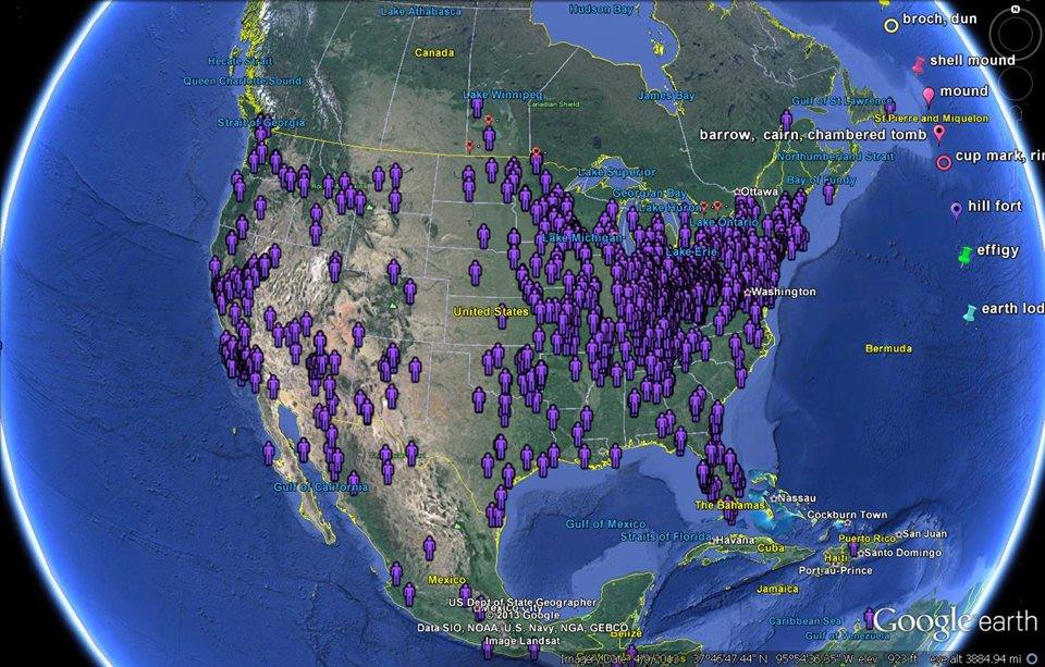
Map of Mound Builder Sites [Vieira, 2013]

The Anunnaki mined gold and copper and used electromagnetic and sonar energy to move huge stones along many mile-lanes of magnetically-charged rocks like those Marduk’s father, Chief Scientist Enki, developed in southern Africa. Anunnaki sites in North America yielded iron implements, cuneiform writing, incised designs, woven fabrics, and evidence of advanced metallurgy.


The Anunnaki took descendants of Ka-in from Asia and of Adamu from Africa across both the Atlantic and Pacific. These Anunnaki and perhaps other extraterrestrials–the moundbuilders–far preceded both the Eskimo and “Indians” who crossed from Asia as well as the South American “Indians”–also descendants of Ka-in and Adamu who came north from the Lake Titicaca area. Some of these giants and their hybrid offspring may have stayed on as rulers of the more recent arrivals to North America, the ones who call themselves “Indians” and came to occupy the mounds of the ETs. Some of the giants had double rows of both upper and lower teeth and may have been cannibals.


Ohio’s Serpent Mound: Template for Cosmic Knowledge


The Serpent Mound, on a plateau of the Serpent Mound crater along Ohio Brush Creek in Adams County, Ohio, is a 1,348-foot-long, five-kilometer-wide,three-foot-high stone effigy of a snake with an egg in its mouth. This mound, which dates earlier than 3000 BCE, sits on a high hill beside one of Earth’s largest geomagnetic anomalies–where an asteroid had millions of years ago, hit, shattered stones down to two kilometers down constantly traps and changes its magnetic and gravitational field and generates “earthlights” when the electromagnetic field hits gases above.
The electromagnetic energy channels through the vast cavern system in dolomite limestone beneath and focuses up through the serpent effigy, where it attracted lightning strikes and Anunnaki aircraft; it also let those who meditated at the site see images.
The serpent’s effigy’s rock coils on the ground outline the constellation Draco in the sky above. Each coil points in the sky above to a point over which an eclipse of the sun or moon, an equinox or a solstice will occur. The seventh coil of the effigy serpent rests directly beneath the only star that held its position through the night in the sky–the Pole Star–the one that appears stationary in the sky above as it was 5000 years ago. The lineup of this Pole Star over the effigy duplicated the lineup of the Pole Star exactly as the siting line the Anunnaki placed at the Great Giza Pyramid in Egypt and the siting stones Marduk’s brother Ningishzidda fashioned at Stonehenge in England. These identical lineups prove the same builders–the Anunnaki–aka the Serpent/Dragon People–constructed all three sites. [Hamilton, 1013]


Poverty Point Louisiana Mound
This mound features in its center, an astronomical wooden calendar of wood, like Stonehenge’s stone calendar. Poverty point’s “embankment and structures would fill the great pyramid of Egypt 30 times with Earth.” The site features a 7-foot high bird effigy. [Vieira, 2013]

Smithsonian Admits to Destruction of Thousands of Giant Human Skeletons in Early 1900s
documents dating from the early 1900’s.Proving the organization had been involved in a historical cover-up of evidence showing giant human remains in the tens of thousands that were uncovered across America that were ordered to be destroyed by upper-level administrators to ensure protection of the mainstream chronology of human evolution in that time.
Allegations were made by the American institution of Alternative Archaeology (AIAA) that the Smithsonian Institution had destroyed thousand so giant human remains during the early 1900’s wasn’t taken so well by the Smithsonian who reacted by suing the organization for defamation and the damage of the 168-year old institution.
During the court case, new evidence was brought in as several Smithsonian whistle blowers admitted to the existence of documents that allegedly proved the destruction of tens of thousands of human skeletons reaching between 6 feet and 12 feet in height, a reality mainstream archeology can not admit to for different reasons, claims AIAA spokesman, James Churchward.
“There has been a major cover up by western archaeological institutions since the early 1900′s to make us believe that America was first colonized by Asian peoples migrating through the Bering Strait 15,000 years ago, when in fact, there are hundreds of thousands of burial mounds all over America which the Natives claim were there a long time before them, and that show traces of a highly developed civilization, complex use of metal alloys and where giant human skeleton remains are frequently found but still go unreported in the media and news outlets” he explains.
A turning point of the case was when a 1.3 meter long human femur bone was shown as evidence in court of the existence of such giant human bones. The evidence came as a blow to the Smithsonian’s lawyers as the bone had been stolen from the Smithsonian by one of their high level curators in the mid 1930′s who had kept the bone all his life and admitted on his deathbed in writing of the undercover operations in the Smithsonian.
“It is a terrible thing that is being done to the American people” he wrote in his letter. “We are hiding the truth about the forefathers of humanity, our ancestors, the giants who roamed the earth as recalled in the Bible and ancient texts of the world”.
The US Supreme Court has forced the Smithsonian Institution to publicly release all classified information about anything related to the “destruction of evidence pertaining to the mound builder culture” and to elements “relative to human skeletons of greater height than usual.
UTAH/ARIZONA/NEW MEXICO
Hopi & Zuni Teaching Temples: KIVAS & THEIR 3 MESAS MIRROR ORION’S BELTLINE TO THE PLEIADES
The orally-transmitted narratives of the Hopi people (who nowadays live at the junction of Utah, Arizona and New Mexico) say Earth’s interconnected world-wide civilizations has taken four forms. Periodic Earth-wide catastrophes triggered by meteorite strikes destroyed the first three forms. After each catastrophe, Anunnaki sages helped the Hopi’s ancestors survive until rock bombardment, fires, floods flood and pole shifts abated.
The Hopi call the Anunnaki sages Katsina, Star People or Ant People; Anthropologists the sages Katchinas. In Hopi rituals the sages are represented by masked dancers, many of whom wear spacesuits and have external antannae on their helmets.

The antennae on their helmets look like ants’ antennae.

Silva writes, “According to Hopi tradition, the First World, Topella, was destroyed by fire. The Second World, Tokpa, came to a close when the poles spun, Earth turned on its axis, north became south” to create the Older Dryas Ice Age.
The Anunnaki watchers [Ant People, Nephilim, Igigi] warned the Hopi, as they also warned Moses “to follow a cloud of unusual shape by day and a moving star [lighted spacecraft or laser point] by night. The cloud and the night light “led them to a mound of the Ant People [Hopi designation of the Anunnaki] in Central America, which the Hopi’s ancestors reached after the mother continent, Kasskara [Lemuria] sunk in the central Pacific.”
“Hopi recall the leader of the Ant People, Anu-Sinon (ant man), as generous, hardworking, willing to provide food to the people and teach them methods of food preservation so they could ride out the prolonged upheaval taking place outside their protective cave (vast man-made cave systems exist throughout the world).
The Anunnaki left the sage Massau’u with the Hopi survivors to help them adapt to the Third World, the one we now experience. Members of Massau’u’s entourage rescued the Anasazi as well as the Zuni, survivors from Japan.
Massau’u supervised the Hopi’s “initial settlement and migrations that followed.” He could fly huge distances and interact with other worlds. Massau’u gave the Hopi “knowledge written on stone tablets.” [Below]

“The Hopi village of Oraibi and two other 600-foot high mesas” resemble the belt of the constellation Orion, which points in the sky to the Pleiades, from which the Hopi say their ancestors came to Earth [Orion’s belt and the Pleides are the focal points of Anunnaki temples placed on Earth’s portals. [Missing Lands: 277-288].
HOPI SACRED SITE # 1: THE MESAS THEMSELVES MIRROR THE LINE FROM ORION’S BELT THAT POINTS TO THE PLEIADES BELOW
“The Hopi village of Oraibi and two other 600-foot high mesas” resemble the belt of the constellation Orion, which points in the sky to the Pleiades, from which the Hopi say their ancestors came to Earth [Orion’s belt and the Pleiades are the focal points of Anunnaki temples placed on Earth’s portals–Missing Lands: 277—288]
HOPI SACRED SITES #2: SEMI-SUBTERRANEAN KIVAS
The word “Kiva” means “World Below.” Within the Kivas small and large, Hopi commune with the Anunnaki (Ant People) sages, other-dimensionals and the giver-spirits of nature.
MARS


On Mars, Nibirans manned a spaceport and lasered a monument to Alalu, one of their kings, who was exiled to Mars and died there. Nibiran Chief Medical Officer, Princess Ninmah, on orders from King Anu of Nibiru, had Pilot Anzu create the statue and left 20 men with him to construct Mars base for transshipment of gold from Earth to Nibiru.
xxx

Related
ANUNNAKI TEMPLES MAGNIFY TELLURIC PULSES TO ENLIGHTEN US
January 8, 2015
ANCIENTS’ TEMPLES SLIDESHOW: STRUCTURES THAT INSTRUCT
July 12, 2015
“GODS” & ANCESTRAL MEMORIES MEET YOU AT SACRED SITES–Here’s How & Why
September 25, 2017

ENKI
previous postADAM’S DESCENDANTS WORKED S. AFRICA’S GOLDMINES 100,000 YEARS UNTIL CLIMATE WORSENEDnext postThoth, Ousted from Egypt by Ra, Built Stonehenge to Map Celestial & Architectural Geometry,
YOU MAY ALSO LIKE
THE ANUNNAKI: Sasha Lessin Video with slides at…
March 31, 2015
Chinese Culture on Its Building Design
July 11, 2017
NIBIRANS SETTLED MARS: Film Proof NASA Hid; Review…
November 22, 2013
Fine Art Project: Underwater
July 11, 2017
ARMAGEDDON 1: Nuclear Storm Yahweh-Enlil Loosed On Sinai…
December 15, 2018
“JESUS DESCENDED FROM ET ENKI, HIS SON CAIN…
October 23, 2012
BOSNIA: ETs Here Before Anunnaki?
September 19, 2017
ALALU LED GIANT HOMO SAPIEN GOLDMINERS FROM PLANET…
October 14, 2014
HOW NANNAR BECAME NIBIRU KING by Sasha Alex…
June 28, 2015
Enki-Adonai’s Hybrid Daughter, TI-AMAT (The 1st Eve), Our…
October 15, 2017


